
This has never happened since official records existed. With 35 consecutive days of rain, France has recorded the longest series of rainfall since 1959, the year systematic measurements began. The data was certified by Météo-France, which confirmed the surpassing of the previous record of 2023, which was stuck at 32 days.
The sequence extends from January 14th to February 17th, a period in which the rains gave no respite. These were not simple isolated showers, but a continuous and persistent flow that transformed the landscape: saturated soil, swollen rivers, flooded countryside and gusts of up to 168 km/h in areas such as Upper Corsica. An event that marks a before and after in the country’s recent climatology.
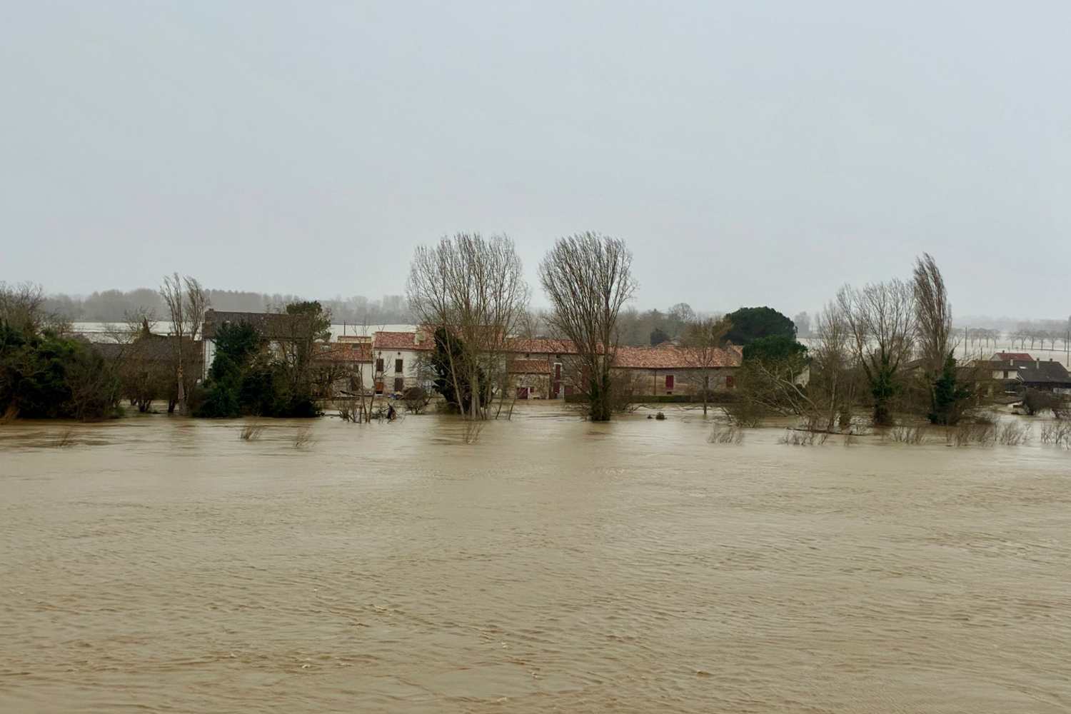
Floods and maximum alert
The consequences are there for all to see. The constant accumulation of water has triggered widespread flooding and floods in several regions. Dozens of departments remain on orange watch, while some areas in the west have been placed on red alert due to critically rising waterways.
The mechanism is relentless: saturated soils are no longer able to absorb new rainfall and any further rainfall turns into runoff directed towards rivers and streams. The result is a rapid increase in water levels, with basins struggling to dispose of the mass of water accumulated in recent weeks.
Storm Pedro and the tidal risk
As if that wasn’t enough, between yesterday and the day before yesterday, Storm Pedro hit the country, a deep depression that brought new rains which clearly fed the waterways again, preventing the drainage of liquids and giving rise to new floods.
Further complicating the scenario is the combination with the large tides on the Atlantic coast. High coefficients are expected in the coming days, with the risk of a pincer effect: on one side the rivers trying to flow into the sea, on the other the ocean which, driven by storm surges and high tides, rises up the estuaries. In cities such as Nantes or Bordeaux the water level could rise significantly during peak tides.
A sign of climate change
Experts warn that such events are not isolated anomalies. The intensification of precipitation and its greater persistence are part of a trend linked to climate change. Warmer atmospheres hold more moisture, fueling episodes of extreme rain.
If a break in rainfall is expected in the next few days, this will not mean an immediate return to normality. Flood dynamics will continue to evolve slowly. After 35 days of uninterrupted rain, France discovers how fragile the balance between sky, land and sea can become.
You might also be interested in: