
From the terrestrial orbit, our planet appears as a fragile blue biglia. But to a more careful look, from that sidereal height, his most recent scars are visible. Deep “wounds” of brown-red color that mark the border between Spain and Portugal and the southern Portuguese coast, silent testimonies of the devastation left by the violent fires flared between August and September 2025. To document them, with an unparalleled precision, it is the “eyes” of the Sentinel-2 satellites of the European Copernicus program, which provide precious data not only to count The damage, but above all to plan the rebirth of these ecosystems.
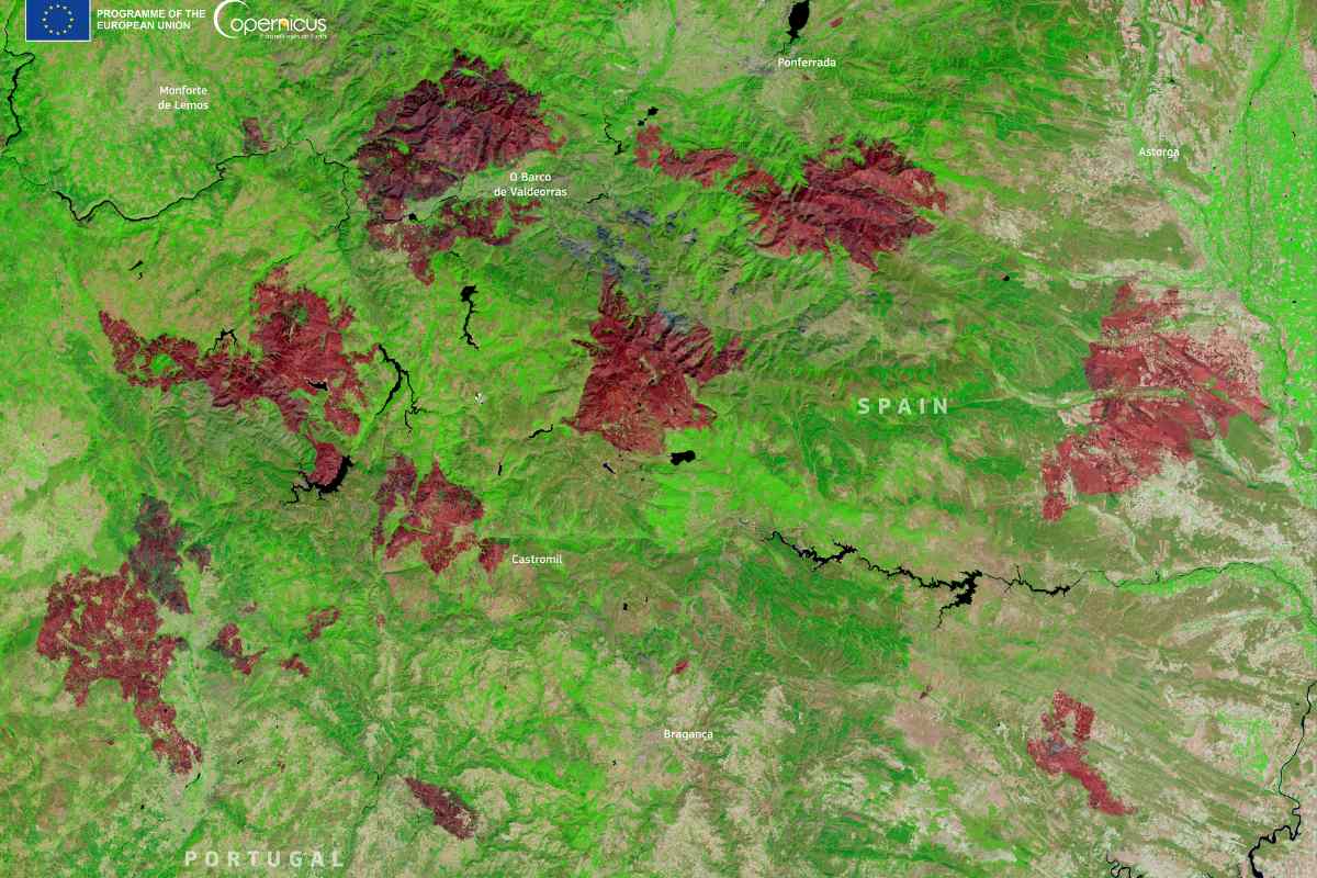
The first large affected area, as emerges from an image acquired on September 5, is that between the two countries. The flames, flared up in August, attacked natural parks and municipal areas, focusing in particular around the municipalities of Castromil, or Barco de Valdeorras in Spain (in the regions of Galicia and León) and Bragança in Portugal. The satellite image, elaborated in false colors to highlight the changes of the soil, is merciless: where before there was vegetation, now vast brick -colored spots extend, which reveal the loss of vegetable cover on the vast scale. A transformed, almost lunar landscape that shows the impact of multiple fires that for days have brought the territory to their knees.
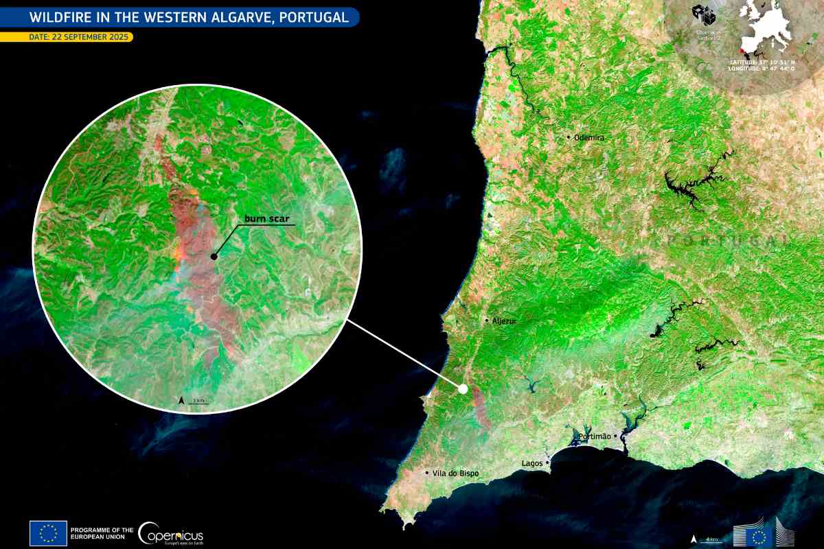
A few weeks later, a new alarm took place further south, in the western algarve region, in Portugal. A single, great fire burned for days in mid -September, affecting the municipalities of Aljezur and Lagos. Also in this case, the intervention of technology proved to be fundamental. An image taken by a Sentinel-2 satellite on September 22, when the stake was now under control, documents the extension of the area crossed by the fire. In the composition with false colors, the burned areas appear in dark brown and red shades, creating a clear and dramatic contrast with the brilliant green of the surrounding vegetation escaped on the flames. An environmental disaster that also had a human cost, with 14 people injured.
These images, provided by the European Union through the Copernicus program, are not just a sad documentation of what has been lost. They represent a work tool of strategic importance. Sentinel-2 constellation satellites are equipped with high resolution optical sensors capable of precisely monitoring changes in the soil coverage. This continuous and detailed observation capacity is the key to post-fire activities.
Thanks to these data, in fact, the authorities can carry out precise and objective assessments of the damages, quantifying the destroyed vegetation for hectare. The information collected is then essential to plan forest recovery interventions, deciding where and how to intervene to encourage the regeneration of the environment and prevent phenomena of hydrogeological instability. Finally, these data support civil protection operations, helping to understand fire dynamics and improve prevention and intervention strategies for the future. The space, therefore, is not limited to observing our fragility, but also offers us the tools to treat them and to try to build a more resilient future.