
In Sardinia on Thursday it came close to 29 degrees. At the Decimomannu station the maximum stopped at 28.8°C, in a still summer climate, and even in the interior of Sicily several locations reached 27-28°C. Further north the values drop, but only slightly: Florence reached 25°C, the North settled at around 22. It is the classic October, with clear and mild days especially in the mountains, where the freezing point exceeds 3,000 metres. It will not last long: according to Luca Lombroso, meteorologist at Meteored Italia, with the third weekend of the month the picture changes, and next week will bring the first rains.
The blockade on Europe
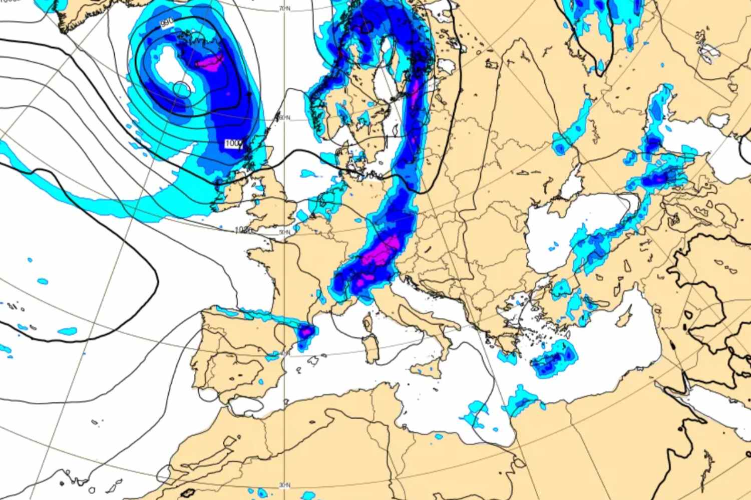
On Saturday 17 October the anticyclone strengthens over Ireland, where it exceeds 1035 hPa, and extends towards Scandinavia. On its eastern edge a wave of the jet stream flows with retrograde motion, i.e. directed towards the west. The trough thus slides towards the west, held back by a second anticyclone that presides over eastern Europe. In the following days, Scandinavian high pressure will hold a depression between France and the Iberian Peninsula. The result will be a stationary front stuck between the North-West and the South, at the height of Sicily and Calabria, with Scirocco currents directed towards the western Alps and the two southern regions. It is the configuration that Lombroso invites us to keep an eye on, due to the risk of torrential rain.
Gray Saturday, still no rain
The weekend opens with increasing clouds over a good part of the peninsula but without any noteworthy precipitation, except for a few brief isolated showers between Liguria, the western Alps and the interior of Sicily. Stable temperatures, slightly rising in the South.
Sunday, a country divided in two
On Sunday 18th bad weather hits the North-West. Intense rain and possible storms will hit Piedmont, Valle d’Aosta and Liguria, and the most exposed area is that of the Orta and Maggiore lakes, where accumulations could exceed 200 millimeters with the risk of rivers flooding. Some showers will arrive as far as western Emilia, while in the center strong thunderstorms are expected in the afternoon between Maremma and Lazio. The North-East, the Adriatic coast and Sardinia will remain dry, as will the South, where sunny spells will last the whole day. The Scirocco will keep temperatures mild everywhere, even where it rains. The maximum temperatures will range from 21-23°C in the North to 22-24°C in the Centre, up to 26-28°C in the South, with equally gentle minimums.
The second thrust was on Tuesday
At the beginning of the week the rains should loosen their grip on the North-West and concentrate on the Maritime Alps and Tyrrhenian Sardinia. It will be a short respite. A new and strong worsening is expected for Tuesday 20th, with torrential rains and storms between Liguria, upper Piedmont and western Lombardy. The North-East will remain drier, while in the Center and South the sky will be cloudy, with tense Scirocco and desert dust over Sicily. In the Center it will rain again on the coasts of Lazio and Tuscany, while the western interior should remain mostly dry and in Umbria, Marche, Abruzzo and Molise the sky will be cloudy, with clear spells towards the sea. In the South the picture is more uncertain: possible rain in Campania and the first intense showers between Sicily and Calabria, with Puglia largely spared. For now, no trace of the cold.
Towards true autumn
By mid-week the disturbance should gradually ease, with widespread rain across the North and a large part of the Center and fast thunderstorms in the South and Sardinia. Temperatures will remain mild, but between overcast skies and precipitation the atmosphere will finally be that of the season. On the details, Lombroso warns, there remain margins of uncertainty that future updates will have to clarify. In short, the conditional is a must.
