
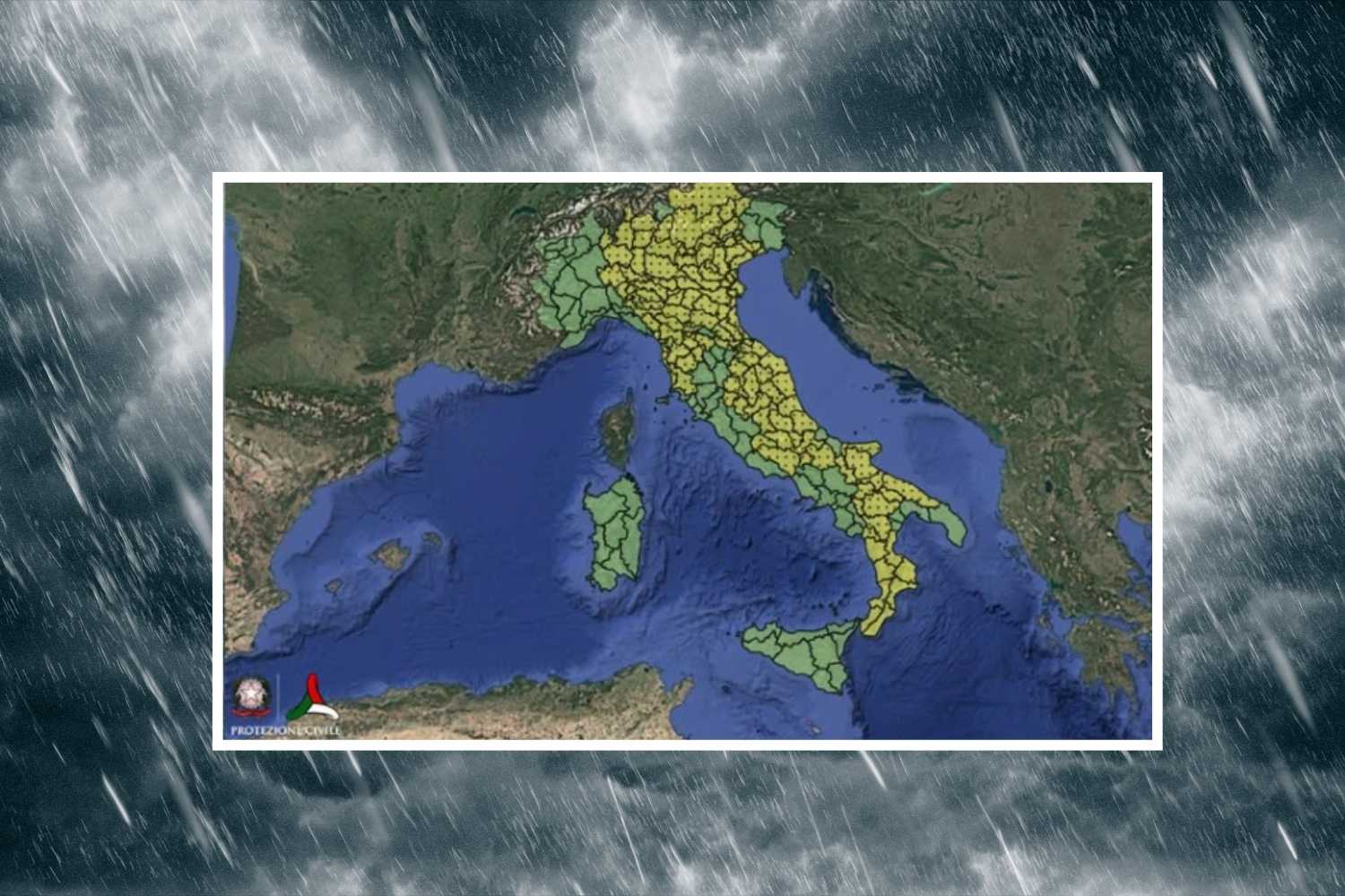
Between Monday 17 and Tuesday 18 August 2026 the meteorological picture in Italy changes significantly, with a more unstable phase affecting numerous regions and bringing with it the risk of thunderstorms, locally intense rainfall and hydrogeological and hydraulic criticalities.
The Civil Protection has reported a widespread yellow alert, corresponding to ordinary critical issues, which involves large sectors of the North, Center and South. The most extensive risk is that linked to thunderstorms, while in some areas attention is also indicated for possible hydrogeological phenomena.
Storms are arriving, yellow alert from North to South
The yellow warning for storm risk affects a particularly large number of territories. In the North, large sectors of Lombardy are involved, from the plains to the Pre-Alps and the Alpine areas, including Valchiavenna, Valtellina, Valcamonica, Bergamo Orobie, Lario, the Varese and eastern Pre-Alps, as well as the Hydraulic Hub of Milan and various areas of the plain. There is also an alert situation in Emilia-Romagna, where the alert concerns numerous areas between Piacentino, Parma, Reggiano, Modenese, Bolognese, Ferrarese and Romagna, including mountain, hill, plain and coastal areas.
The alert framework in Veneto is also very extensive, from the Dolomites to the Pre-Alps up to the plains and coasts. Affected, among others, Agordino, Cadore, Comelico, Valbelluna, Feltrino, Alpago, Treviso and Vicenza Prealps, high plain, central and eastern plain, Polesine and coastal areas. Yellow warning for thunderstorms also in both autonomous provinces of Trentino-Alto Adige.
Central Italy under observation
In the Centre, Tuscany is among the regions most involved. The alert affects Lunigiana, Versilia, Garfagnana, the Serchio basin, the northern coast, Etruria, Valdelsa and Valdera, lower Valdarno, the Florentine area, Mugello and Val di Sieve.
In Umbria all the main areas indicated by the regional warning system are involved: Upper and Middle Tiber, Chiascio-Topino, Trasimeno-Nestore, Nera-Corno and Chiani-Paglia.
In the Marche the alert affects the various regional sectors, while in Abruzzo the attention is paid to the Marsica, the Tordino-Vomano, Alto Sangro, Pescara and Aterno basins. In Lazio, the Liri basin, the Aniene and the Rieti Apennines are especially under alert.
Instability also in the South and hydraulic risk in Calabria
The storm phase also reaches the South. In Molise the Frentani-Sannio-Matese and Alto Volturno-Medio Sangro areas are affected. In Basilicata the alert includes all the areas indicated as Bases-A1, Bases-A2, Bases-B, Bases-C and Bases-D.
In Puglia the focus is on the Gargano and Tremiti, the Tavoliere, the Lower Fortore, the Daunian Sub-Apennines, the Lower Ofanto and various sectors of central Puglia, both Adriatic and Bradanic. The alert is particularly widespread in Calabria, where practically all the main regional slopes are involved, both Ionian and Tyrrhenian, from the northern to the southern sectors. Calabria itself presents a more complex picture. In addition to the yellow warning for thunderstorms, the Civil Protection reports ordinary criticalities for hydraulic risk on the various regional sides. This means that rainfall, especially if concentrated in short periods and particularly intense, could lead to minor rises in watercourses and localized critical issues in the most vulnerable areas.
Also in Calabria, a yellow alert is also foreseen for hydrogeological risk, linked to the possibility of effects on the ground such as runoff, accumulations of water and local instability phenomena.
The ordinary criticality due to hydrogeological risk does not only concern Calabria. The yellow alert also affects Molise, in the Frentani-Sannio-Matese and Alto Volturno-Medio Sangro areas, as well as numerous sectors of Tuscany, including Lunigiana, Versilia, Garfagnana, the Serchio basin, Valdarno, Mugello and Etruria. Both autonomous provinces of Trentino-Alto Adige, Bolzano and Trento are also involved.
The sharpest change will come around August 20th, when temperatures are expected to drop by around 8°C.
