
When the European sky takes on orange hues and the air seems veiled in a milky light, it often means that an atmospheric story that began thousands of kilometers away has reached us. The rain of blood observed in several European regions at the beginning of March 2026 was born in the heart of the Sahara, the largest natural reservoir of mineral dust on the planet.
Every year the African desert releases enormous quantities of fine particles that the wind can lift and transport for thousands of kilometers. In particular meteorological conditions these masses of dust cross the Mediterranean and reach Europe. This is exactly what happened in the first days of March, when a gigantic Saharan cloud transformed the sky of many European cities, making the light opaque and dyeing the horizon red.
In several countries, including Spain, France, the United Kingdom and parts of Italy, rainfall has absorbed sand suspended in the air. The result was the fascinating and unusual phenomenon we call blood rain, a rain that leaves a thin rust-colored patina on roofs, streets and cars.
However, behind this almost surreal scenario lies a very precise atmospheric mechanism, reconstructed in detail by scientists thanks to satellite observations and NASA climate models. Between March 1 and 9, 2026, strong winter winds lifted huge amounts of sand from the northwestern Sahara. Once they entered the atmosphere, these particles began a long journey northwards, pushed by the currents that connect Africa to Europe.
Scientists reconstructed this path using NASA’s Goddard Earth Observing System (GEOS) model, a system that combines satellite data and mathematical models to track the movement of aerosols in the atmosphere. Thanks to these simulations it was possible to observe the birth of gigantic dust plumes over North Africa and their progressive movement towards the Mediterranean.
Part of the cloud dispersed over the Atlantic Ocean, while another crossed the sea and reached Western Europe. On those days, many regions recorded dull, milky skies, with intensely orange sunsets and reduced visibility. Satellite images showed very high concentrations of aerosols over France as early as March 5, 2026, a sign of the presence of a huge mass of desert dust that continued to move north.
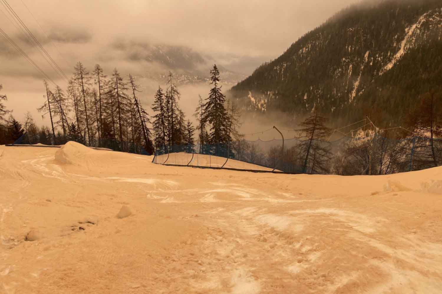
The Saharan cloud reached territories very distant from each other: from the coasts of the United Kingdom to the Alps between Switzerland and Italy, where a thin layer of sand was deposited even on the Matterhorn glaciers. Similar scenes had already been observed in the past. A photograph taken in April 2024 showed the Acropolis of Athens immersed in a cloud of Saharan dust, with an almost ghostly atmosphere that made the desert seem suddenly close to the city.
What happens when Sahara sand meets European disturbances
Not all dust remains suspended in the atmosphere. A part encounters disturbed systems rich in humidity and is incorporated into precipitation. This is how the rain of blood is born. When raindrops pass through an air mass full of desert dust, they incorporate sand particles and transport them to the ground. After the rain, a thin reddish-brown film remains that covers surfaces, cars and windows.
In this case the phenomenon was favored by the Queen Storm, an atmospheric depression that crossed the Iberian Peninsula bringing widespread rainfall just as the Saharan cloud reached Western Europe.
According to MeteoSwiss, some of the dust managed to rise to the upper troposphere, where it contributed to the formation of so-called dusty cirrus clouds. In these very high clouds, grains of sand become nuclei around which ice crystals aggregate.
The visual result can be spectacular. On March 8, 2026, for example, above Mount Wurmberg in Germany the sky transformed into a reddish expanse of Saharan dust that lit up the horizon with intense hues.
The invisible effect of blood rain
The most obvious aspect of these events concerns the color of the sky. However, the presence of large quantities of dust in the atmosphere can have very real consequences. A study based on NASA’s MERRA-2 data analyzed the impact of Saharan dust on photovoltaic energy production. During the most intense episodes, the amount of solar radiation reaching the ground decreases significantly because part of the light is reflected or scattered by particles suspended in the air.
In Hungary, during particularly intense events, the yield of solar systems decreased by up to 46%. The increase in the reflectance of clouds and aerosols reduces the direct solar radiation reaching the panels. Another consequence concerns air quality. Saharan dust mainly belongs to the category of PM10 particles, small enough to enter the airways and irritate the respiratory system, especially in the most sensitive people.
Why these events worry scientists
In recent years, several studies indicate that large transports of dust from the Sahara towards Europe could become increasingly frequent and intense. Among the possible causes, experts point to persistent droughts in North Africa, which make the soil more vulnerable to the action of the wind, and some changes in atmospheric circulation which favor the movement of desert air masses northwards.
Understanding these phenomena means improving weather forecasts, studying the impact of dust on the climate and evaluating the consequences on public health and renewable energy. The rain of blood remains one of the most surprising spectacles that the European sky can offer. At the same time it tells how deep the atmospheric connections are between distant continents and how the African desert continues to influence, often invisibly, daily life in Europe.
You might also be interested in: