
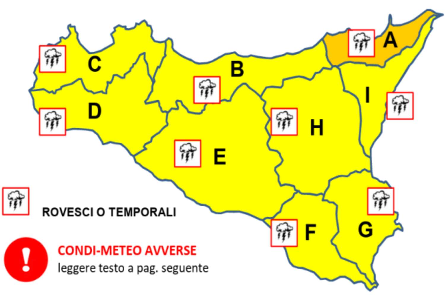
There is no peace for the already tormented Sicily which is preparing to deal with yet another disturbance. For today, Thursday 12 February, the regional civil protection has issued a yellow alert bulletin across the entire island, with an orange level on the Tyrrhenian coast of Messina, the area that could suffer the most significant effects.
There is an extratropical storm on the way linked to a deep pressure low that will develop over Northern Italy and then slide towards the middle Adriatic. A configuration that will rapidly increase the baric gradient, triggering strong westerly winds and storm surges along much of the Sicilian coast.
Gale winds and significant storm surges
The forecast calls for gale to strong winds, with gusts that could exceed 100 km/h, especially on the ridges of the northern mountain ranges. Even higher peaks cannot be ruled out on the findings. But it will be the sea, once again, that causes concern. Very rough conditions are expected in the central-southern Tyrrhenian Sea and the Strait of Sicily, with waves of up to 5-6 meters in the western sectors.
The Ionian Sea will go from very rough to rough. In the areas between Sardinia, Calabria and the lower Tyrrhenian Sea, the rapid rotation of the winds could favor interference phenomena between wave motions, with the possibility of even higher anomalous waves in the open sea. The northern coasts of the island, from Trapani to Messina, are among the most exposed to storm surges and erosion phenomena, with possible flooding of beaches and port infrastructure.
Abundant rain but no extreme scenarios
On the rainfall front, no exceptional accumulations are expected, but heavy rainfall is expected in the Tyrrhenian sector, even in the form of showers or thunderstorms. The snow level will remain very high, above 2000 metres, a sign of a not particularly cold air mass.
Experts make it clear that the situation, while serious, will not reach the levels seen during Cyclone Harry. This is a different system, with the low pressure center expected to transit higher latitudes than that event.
The most intense phase should be concentrated over less than 24 hours, but it will be enough to make Thursday particularly delicate for navigation, coastal activities and travel in the most exposed areas. The invitation remains to be cautious, especially along the Tyrrhenian coasts and in the windiest mountain areas.
You might also be interested in: