
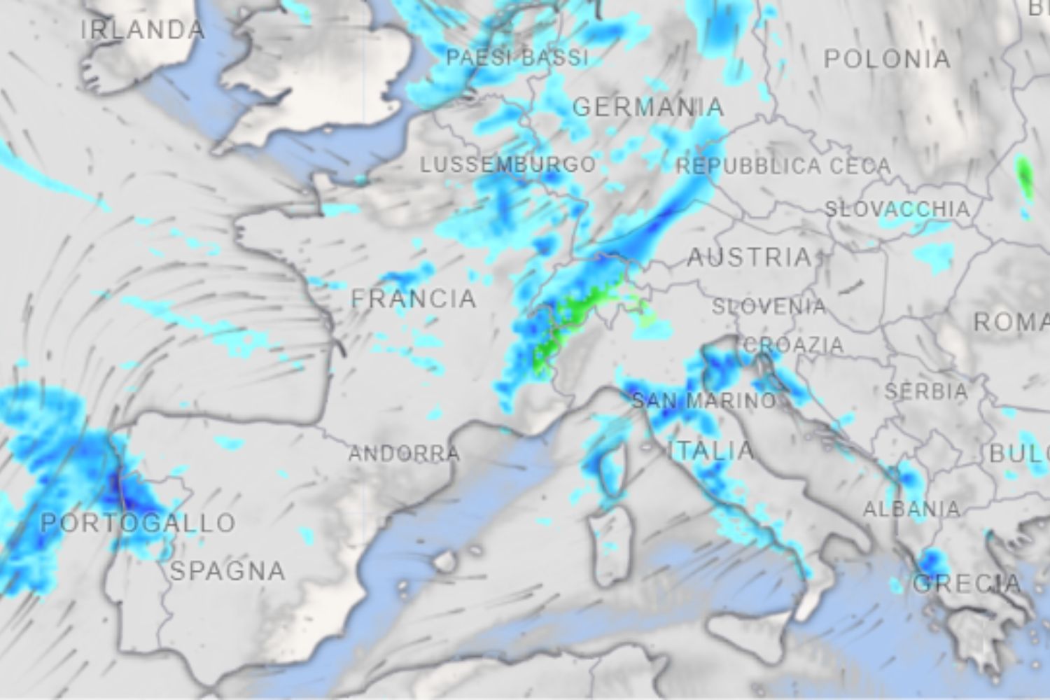
From the Caribbean to Italy, crossing thousands of kilometers of the Atlantic Ocean: it is the path of a huge corridor of tropical humidity that will contribute to fueling a new wave of bad weather in our country in the coming days. It is called an atmospheric river and could bring particularly intense rainfall between Sunday 15th and Monday 16th November, especially in the Tyrrhenian regions and in the North-East.
The greatest concern concerns the territories already affected by the storms of the last few days, which discharged over 300 millimeters of water between Liguria and upper Tuscany. Here the soil is already saturated and the arrival of new heavy rainfall could increase the risk of flooding and landslides.
This scenario is outlined by Daniele Ingemi, meteorologist at Meteored Italia, who draws attention to an Atlantic disturbance fueled by large quantities of water vapor of tropical origin. And while some regions are preparing to deal with new storms, in the South it will almost feel like spring, with temperatures that in Sicily could exceed 25 degrees.
What is the atmospheric river that will bring new rains to Italy
It is not a real river, but a long corridor of water vapor that transports large quantities of humidity from tropical regions to mid-latitudes, even traveling thousands of kilometers. When this flow reaches the Mediterranean and encounters a disturbance or mountainous relief, it can favor the formation of very intense rainfall.
As Ingemi explains, the humidity of tropical origin will add to that already present in the Mediterranean, increasing the potential for precipitation and prolonging the phase of instability. The main risk concerns territories where the ground is already saturated with water due to recent rains: further heavy rainfall could lead to flooding, landslides and hydrogeological criticalities.
The most affected regions
According to forecasts, the worsening will mainly affect the areas exposed to the humid currents of Libeccio, starting from the Tyrrhenian regions. Upper Tuscany, Lazio and northern Campania will be among the most exposed areas, with widespread rainfall, frequent showers and possible thunderstorms. Particular attention should be paid to Eastern Liguria, between Genoa and La Spezia, where the meeting between humid currents and relief could further intensify rainfall, with locally high accumulations. The disturbance will also reach the North-East, affecting Veneto, Friuli-Venezia Giulia and part of Trentino-Alto Adige, especially along the pre-Alpine and foothill areas. Significant rainfall is also expected in some sectors of the northern and central Apennines.
Between Sunday and Monday, therefore, rainfall could be particularly persistent in the Tyrrhenian regions, while in the North-East the phenomena should be more widespread but generally less concentrated.
In the South temperatures up to 25 degrees: Italy divided in two
While the Centre-North will have to deal with rain and thunderstorms, a large part of the South and the Adriatic sectors will remain on the margins of the disturbance. Here the weather will generally be drier and above all very mild, with temperatures above seasonal averages. In Sicily, temperatures could reach and exceed 24-25°C, decidedly high values for mid-November. An Italy is therefore expected to be divided in two, with intense rainfall in some regions and almost spring-like conditions in others.
The exact trajectory of the disturbance and the distribution of rainfall may still change in future updates. It will be important to follow the Civil Protection bulletins, especially in the areas already affected by the storms, where even new rainfall of moderate intensity could worsen the conditions of the area.
