
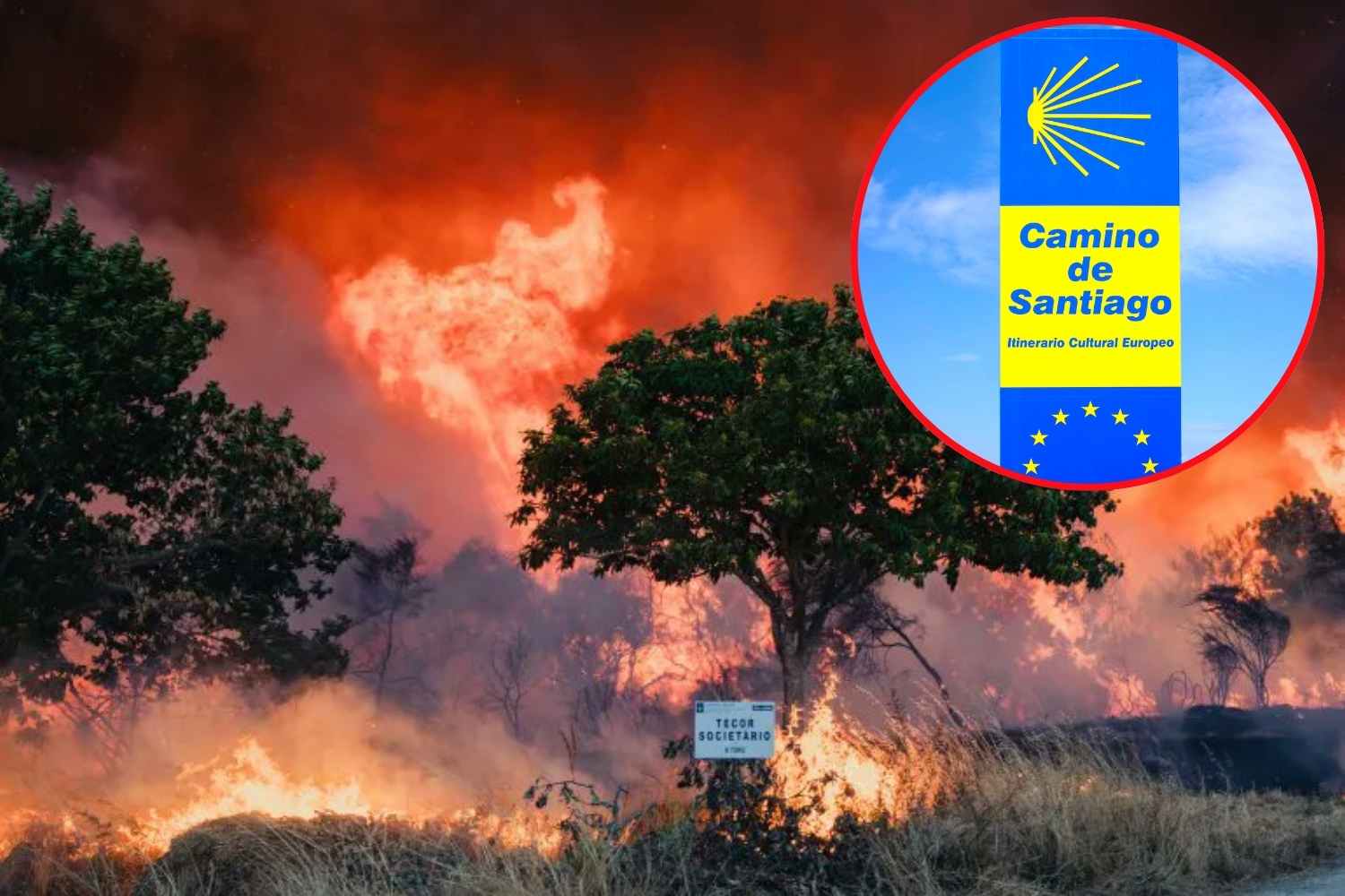
Over 150,000 hectares burned since the beginning of the year according to official Spanish data (more than 200,000 according to European satellite estimates), around 90,000 people involved in evacuations and confinements at the peak of the emergency and only one stretch of the Camino really out of use, even if a good part of the countries involved have already returned to normality in the last 48 hours. This, in short, is the updated photograph of the fires that have been affecting central Spain since mid-July, a figure that undermines the idea, also circulated among pilgrims in social groups, that the entire Camino is at risk.
Eighty thousand hectares burned, ninety thousand people evacuated and confined, and only one stretch of the Camino was truly out of use. This, in short, is the picture of the fires that have been affecting central Spain since mid-July, a fact that alone disproves the idea, also circulated among pilgrims in social groups, that the entire Camino is at risk.
What is burning, and where
The most serious front is located between the provinces of Ávila, Madrid and Toledo. On July 24, the Ministry of the Interior declared an emergency of national interest, after the Community of Madrid had merged into a single fire, renamed #IFSierraOeste, three separate fires that broke out in the areas of Villa del Prado, San Martín de Valdeiglesias and Almorox.
The fire burned around 34,000 hectares in the Madrid area alone (27,000 according to the latest figure released by President Isabel Díaz Ayuso on 29 July, a sign that the data is still being revised downwards as the perimeter is consolidated), to which are added tens of thousands of hectares in the province of Ávila, where the associated fire was defined by the international press as one of the largest ever recorded in Spain. Over 2,800 people received healthcare and around a hundred homes were destroyed, according to the regional government.
A second front, that of La Mierla, has been burning since mid-July in the north of the province of Guadalajara: the most recent estimate speaks of around 35,000 hectares, largely within a protected natural area, and is considered the worst fire in the history of Castile-La Mancha. It was declared stabilized on 23 July and the evacuated municipalities have been gradually returning since 24-26 July.
Neither of the two fires touches Galicia nor the most popular stages of the French Way. It is worth remembering, to frame the gravity of the season, that the deadliest fire of 2026 has nothing to do with the Camino: it is that of Los Gallardos, in the province of Almería, which broke out on 9 July, which caused 13-14 deaths and is the most tragic in recent years in Andalusia.
The budget is updated day by day
Here it is worth pointing out something that the articles published at the end of July could not yet have known: the official page of the Community of Madrid, updated in real time, now speaks of a stabilized fire, with over 56,500 people evacuated and confined over the weekend of 25-26 July (peak close to 91,000 if the municipalities of Ávila and Toledo are also counted), a figure which rapidly decreased in the following days.
Between 27 and 29 July, the Ministry of the Interior authorized the gradual return of most of the evacuated Madrid municipalities, although some urbanizations in San Martín de Valdeiglesias and Pelayos de la Presa, around the San Juan basin, are still unusable, where the clean-up operations of the remaining outbreaks are continuing. At the same time, in the province of Toledo, the Ministry of the Interior has already authorized the return to nine of the eleven towns evacuated due to the Burgohondo fire.
The stages of the Camino involved
The stretch that really interests those who walk is the one shared by the Camino del Sudest and the Camino del Levante between Cadalso de los Vidrios and Ávila, in the valley of the Alberche river. But be careful: the situation here has changed compared to a few days ago. Cadalso de los Vidrios, Cenicientos and El Tiemblo (the latter municipality involved in the Ávila front) are no longer among the confined areas according to the latest official updates, and the M-501 road, which goes up the valley and which until 27 July was closed on a stretch of over 20 kilometres, has been reopened to traffic except for direct access to Pelayos de la Presa. However, some minor roads remain closed around San Martín de Valdeiglesias, Robledo de Chavela and Pelayos de la Presa (M-512, M-521, M-537, M-539, M-957), where the ground remains unstable and reclamation operations are still underway: there is still no walking on these segments today.
In summary: the stretch is technically reopened in its main part, but crosses an area that has just emerged from a large fire, with charred vegetation, possible instability of the ground and air quality still to be verified day by day. Those planning to hike it in the next few weeks would do well to check the updated status before leaving, rather than assuming that it is as passable as before.
The French, Portuguese, Northern, Primitive and English Ways remain regularly practicable, no authority has issued warnings to pilgrims on these routes, unlike what happened in August 2025 between Astorga and Ponferrada, when a record-breaking wave of fires (over 344,000 hectares burned across Spain according to Reuters) forced the closure of a stretch of around 50 kilometers of the Way French on the slopes of the Picos de Europa.
The fire season in numbers
The overall figure for 2026 varies depending on the source, as often happens when comparing satellite data and ministerial data: the European EFFIS system already estimated at the end of July over 170,000 hectares burned in Spain since the beginning of the year, while the Ministry for Ecological Transition stopped at just over 125,000. However, it remains one of the worst seasons of the last decade. On 25 July, the President of the European Commission Ursula von der Leyen announced, via a message on her social media channels, the sending of four planes from the rescEU fleet to Spain, while other European vehicles were diverted to France, hit in parallel by a wave of fires of its own.
What to do if you’re on the road these days
The real risk for those walking today is not so much running into flames, but rather breathing the air that the flames leave behind or finding themselves on a stretch that has only formally reopened. The Community of Madrid recommends that the vulnerable population avoid physical exertion outdoors in the affected areas and wear a mask in the presence of visible smoke; those suffering from respiratory or allergic diseases would do well to postpone the stages where the sky is visibly clouded. It is also useful to download AlertCops, the app of the Spanish security forces, which includes a mode dedicated to pilgrims to share their location and receive alerts in real time.
DGT InfoCar remains the reference point for the state of the roads throughout the country, while fire risk forecasts can be found on the AEMET portal. some pilgrims also report the fire/burnt area map integrated into the Wise Pilgrim app, which draws on Copernicus/EFFIS data, as useful. In case of smoke or flames on the route, the rule always remains the same: move away in the opposite direction to the wind, look for areas already burned or waterways, and call 112.
