
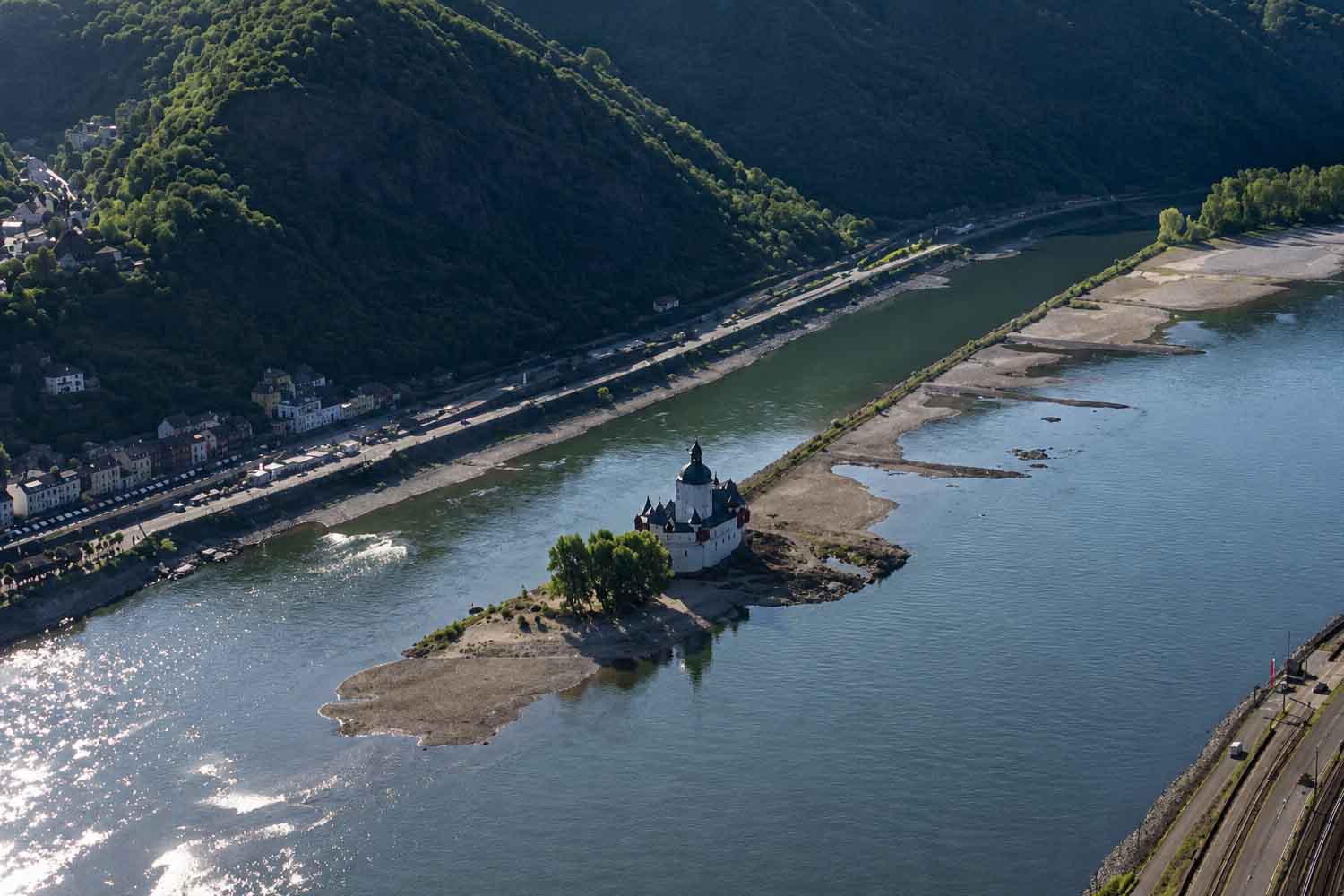
At five in the morning on August 13, Kaub’s meter read 11 centimeters. The day before there were 12, on August 9th again 23. In four days, ten centimeters of water disappeared from the hydrometric level of the Rhine in one of the most delicate points for European commercial navigation. The result can be seen on the barges: many are no longer able to cross this stretch of the Middle Rhine, others travel with a fraction of their usual load. Some remained south of Kaub, others reversed course towards the north.
The data recorded by the Wasserstraßen- und Schifffahrtsverwaltung des Bundes (WSV), the German Federal Waterways Administration, is now well below the 25 centimeters of 22 October 2018, still indicated in the official sheets as the previous reference minimum. And the descent, at least for now, does not promise a rapid reversal.
Those 11 centimeters are not the depth of the Rhine
Here, however, we need to clear up a rather easy misunderstanding. The Rhine has not become a trickle eleven centimeters deep. The Kaub value indicates the height of the water compared to the conventional zero of the hydrometric station, set at 67.669 meters above the German reference level. The depth actually available in the navigable channel is greater and also depends on the conformation of the seabed.
The WSV itself indicates for Kaub a Gleichwertiger Wasserstandthe reference level used for navigation in low water conditions, of 77 centimetres. At that level corresponds to a reference depth of the waterway of 1.90 metres. Seeing the gauge drop to 11 centimeters therefore means losing an enormous margin for the draft of ships, especially those loaded with heavy goods. And that’s where the problem quickly shifts from hydrology to corporate finances.
Kaub is particularly sensitive because it lies on a narrow, shallow stretch of the Middle Rhine, along one of the major routes used to bring raw materials from North Sea ports to Germany’s industrial heartland. A few centimeters here decide how many tons can be loaded onto a ship.
Barges that can still move must lighten themselves to avoid hitting the bottom. In the northern stretches some are traveling with loads around 20% of capacity. Making five trips where normally one would be enough is an effective way to continue transporting goods. Much less to do it cheaply.
From 24 thousand to 14,500 tons per day
An example comes from the route that connects Rotterdam to Duisburg. Under normal conditions HGK Dry Shipping transports approximately 24 thousand tons of coal and ore per day on this corridor. With the Rhine so low it manages to move around 14,500 by river: almost 40% less.
To keep the Hüttenwerke Krupp Mannesmann steelworks in Duisburg supplied, RheinCargo therefore began to shift some of the traffic onto the tracks. Three return rail journeys per week are initially planned between Rotterdam and Duisburg until the end of September, with around 2,000 tonnes of coal carried by each train. The operator directly described the intervention as a response to the poor situation on the Rhine.
The problem cuts across several parts of German industry because fuels, minerals, chemicals, steel, grains and other raw materials travel along the river. When barges need to reduce their load, more vehicles are needed to move the same amount of cargo. When passage becomes impassable, rail or road remains, assuming there is capacity available.
The Rhine continues to flow. From a logistical point of view, however, in Kaub it almost begins to behave like a road with one lane closed and the other too narrow for trucks.
Forecasts do not yet show a real recovery
The next few days are also not very reassuring. The 14-day forecast of the Bundesanstalt für Gewässerkunde (BfG), the German Federal Institute of Hydrology, assigns a 100% probability that the average daily level of Kaub will remain below 77 centimeters until at least August 19. Even towards August 25th the probability remains around 95%. These estimates are subject to precipitation trends, with uncertainty that increases as time goes further away, but at the moment the rain capable of quickly putting water back under the keels does not appear in the picture.
The new low comes after weeks of heat and low rainfall across much of central Europe. Attributing a single drought episode directly to climate change requires specific analyses. The vulnerability of navigation on the Rhine to hotter summers and prolonged periods of low flow, however, has been studied for years by the BfG itself: the projections used by the body indicate the possibility of longer and more frequent summer low water phases for the future.
For now just look at Kaub. In 2018, 25 centimeters had become the symbol of the Rhine crisis. On 13 August 2026 the meter marks 11. On the river, meanwhile, coal and minerals are already taking the train.
Rijn – Aanhoudende droogte en greenr dalend waterpeil zorgt mogelijk voor tweedeling vd rivier
De gevolen van de recordbrekende hittegolven van deze zomer worden steeds duidelijker. From aanhoudende droogte heeft de scheepvaart op de #Rijn – een van Europa’s belangrijkste… pic.twitter.com/3UmAIt7TGu— Johanns (Alpen)weer @johannsalpenweer.bsky.social (@Alpenweerman) August 10, 2026
