
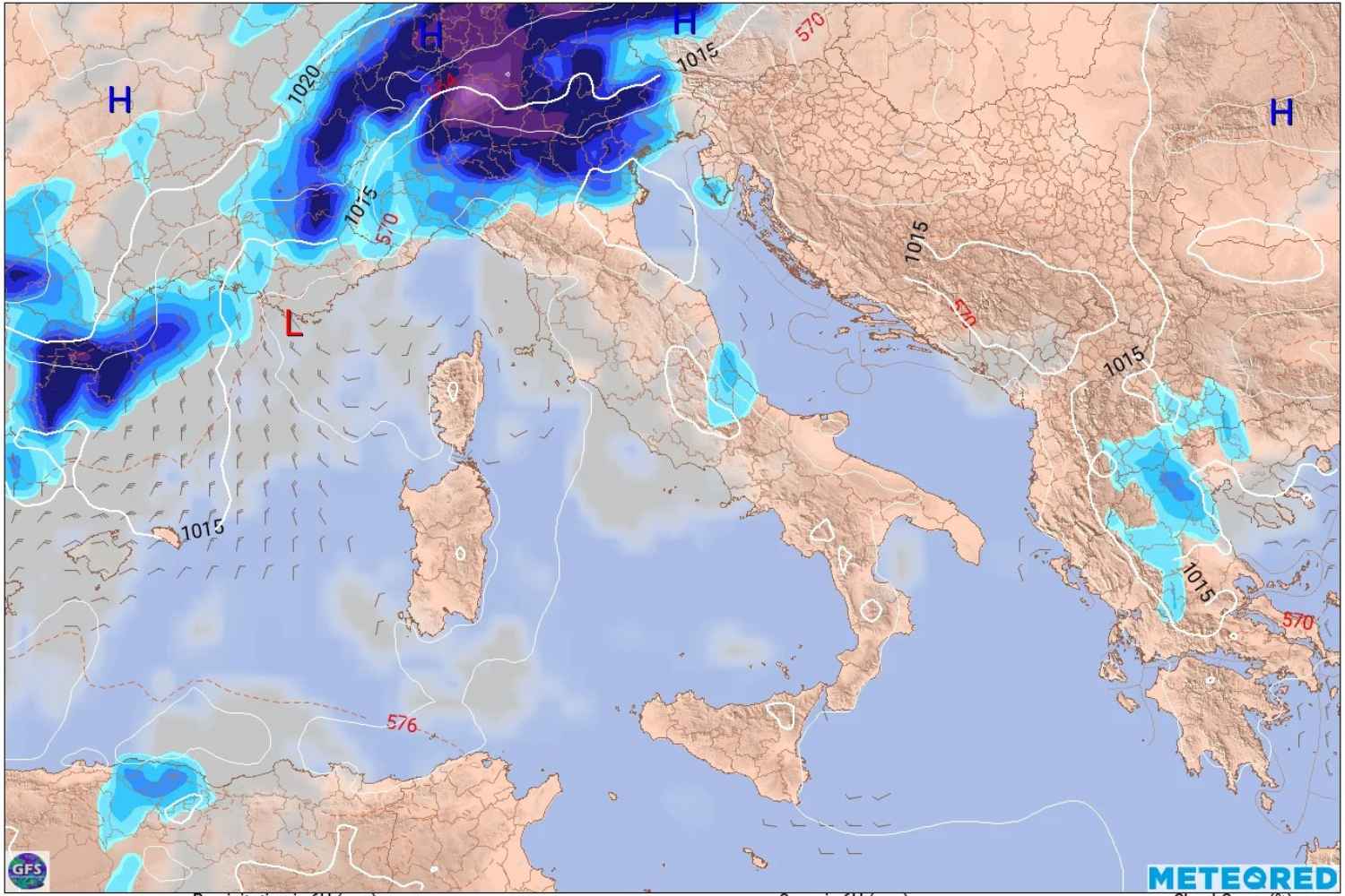
After a start to September marked by temperatures decidedly above average, the Italian meteorological picture is destined to change. According to Luca Lombroso, meteorologist and editor of Meteored Italia, as early as Tuesday 8 September the undulation of the polar jet stream will favor the approach of a disturbance, with an increase in instability first in the northern regions and then in the rest of the Peninsula.
Late heat characterized the first days of the month, with temperatures above 35 degrees in several Italian cities. A situation which, at least in the next few days, should progressively reduce.
@meteored
The disturbance comes from the west
According to Lombroso, after the dominance of the African subtropical high pressure, the European atmospheric circulation is ready to change.
A trough will begin to emerge west of the Alps, and then erupt with a cold front between 8 and 9 September. A probable formation of a depression on the ground is also observed, which could also bring an autumnal rainy phase to the North.
The entry of cooler air at high altitude, in contact with a still very warm and humid air mass present over Italy, could therefore create favorable conditions for the development of locally intense thunderstorms.
In the South, however, the heat should last longer thanks to the greater influence of the anticyclone.
Monday 7 September still hot and sunny
Monday 7 September will still be characterized by predominantly summer conditions across much of Italy. Widespread sunshine and high temperatures will accompany the start of the week, with values that in some areas may still approach 35-37 degrees.
The first signs of change will be visible above all in the Alps, where instability may increase during the day.
Tuesday 8 September, first strong storms in the North
The turning point is expected to become more evident from Tuesday 8 September. During the afternoon, the probability of showers and thunderstorms will increase along the Alpine arc and, locally, on the Apennine ridge.
As the hours pass, the phenomena may become more organized and, according to current projections, reach the plains of Piedmont and Lombardy in the evening.
It will be the first concrete sign of the arrival of the disturbance destined to affect Italy in the central part of the week.
Wednesday 9th and Thursday 10th September, the most delicate phase
Between Wednesday and Thursday the worsening should enter its most significant phase. Rain and thunderstorms will initially affect the North and part of the Centre, before moving towards the southern regions and the major islands. Above all, it will be the intensity of some phenomena that requires attention.
Unfortunately, with the pre-existing heat and warm seas, we will also have to deal with harmful phenomena”, warns Lombroso. «In this type of situation, storms are to be expected in particular, with large quantities of rain in some areas of the North. Future updates will be necessary to more precisely identify the affected areas.
The forecast remains subject to variations, especially regarding the location of the most intense storms and precipitation accumulations.
Temperatures decreasing, especially in the North
The passage of the disturbance should also be accompanied by a decrease in temperatures. The projections of the main models indicate maximum values generally between 25 and 28 degrees in the North, while in the Centre-South the drop could be less marked, with temperatures still approximately between 28 and 35 degrees depending on the area. Rather than a definitive entry into autumn, it would therefore be a return to thermal conditions more in line with the period.
Second weekend of September between variability and new disturbances
Between Friday 11th and Sunday 13th September the scenario could remain dynamic, with lower temperatures and new rapid disturbances, especially in the northern regions.
However, it is not yet the time to talk about a stable autumn. After weeks of anomalous heat, Italy should enter a phase characterized by greater oscillations: short warm comebacks may alternate with cooler and more unstable impulses. In the North, maximum temperatures could often reach 26-28 degrees, while in the Centre-South, values around 30-34 degrees will still be possible.
The most important signal, therefore, is not so much the definitive end of summer as a clear change in atmospheric circulation: after the long warm parenthesis, September could finally show a more variable and disturbed face.
