
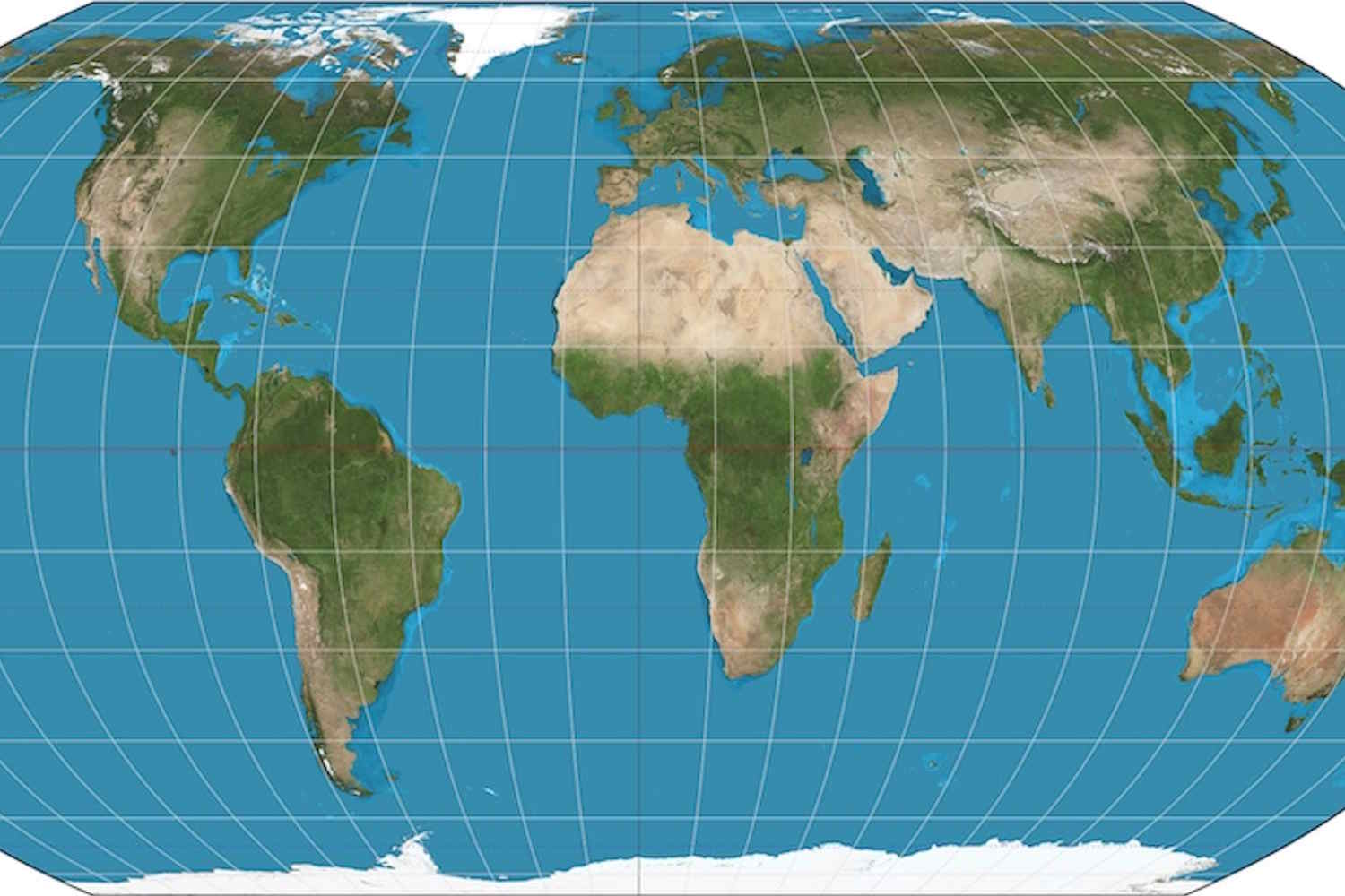
The current map of the world, the most used and created even in 1569 by the Flemish Mercatorrepresents angles and directions quite precisely, but – wanting to transport the shape of the Earth onto a flat surface – it alters the dimensions of the emerged lands, making Africa decidedly smaller.
Reason why, after several centuries, the United Nations has decided to “encourage” states and international organizations to use projection Equal Earth and orient ourselves on projections that are more faithful to the real surfaces of the different continents.
The UN General Assembly thus approved a resolution to promote the adoption of world maps that are more faithful to the real dimensions of the continents. The text, promoted by Togo by the African Union and co-sponsored by France, was adopted with 164 votes in favour.
“Maps shape our understanding of the world,” said Robert Dussey, Togo’s foreign minister, before the vote. They guide education, nourish the imagination and influence collective perceptions.
The African Union has joined the call to replace the outdated 16th-century Mercator map which distorts Africa’s true size, with the Equal Earth projection, a map that shows the continent as it really is: vast, powerful, and central to our world. #CorrectTheMap
“It might seem… pic.twitter.com/w32jt3ExsI
— African Union (@_AfricanUnion) August 14, 2025
All reasons why, most likely, the only ones to abstain were Trump’s United States, while Estonia, Georgia, Lithuania, Moldova, Serbia and Ukraine abstained.
Behind this apparently technical debate, in fact, lies a broader one on history and power. The one currently in use is a map designed for European sailors in the 16th century and inevitably, over generations, it has distorted not only the geography but also the perception of an entire, vast and complex continent.
The map currently in use
The Flemish cartographer of the sixteenth century Gerhard Kremerwhose Latinized name is Gerardus Mercator, he conceived his projection in 1569 to solve a practical problem of maritime navigation. Since the straight lines on his map correspond to constant compass directions, sailors could use it to plot their routes.
But the intent to preserve direction has come at the expense of the surface: land masses appear increasingly enlarged as they move away from the Equator. Greenland, for example, may appear roughly comparable in size to Africa, even though Africa is about 14 times larger. Northern Europe and North America are similarly amplified compared to the equatorial regions.
Despite its original navigation purpose, Mercator navigation has remained common in educational, media, digital and official materials.
The resolution
Now, the UN resolution states that such distortions have contributed to “symbolic minimization” of Africa and have perpetuated an unbalanced vision of the world. Togo led the negotiations on behalf of the African group, based on a campaign supported by the African Union.
On Friday, the United Nations General Assembly adopted an African proposal for a new world map, which shows countries’ true size relative to one another.
In favor: 164
Against: 1
Abstentions: 6 pic.twitter.com/5BE4LUiojH— UN News (@UN_News_Centre) September 4, 2026
The resolution describes correcting such distortions as an act of “cognitive justice and memorial repair” and points to Equal Earth, developed in 2018, as a projection that more accurately represents relative size.
A fair map doesn’t change the geography of the world, it changes the way we see the world, said Dussey, whose call is for more accurate representations to be adopted in schools, institutions and digital technologies.
France also joined the campaign.
The United States, Russia and China assume a disproportionate visual importance compared to Africa, Latin America or Southeast Asia – said French Foreign Minister Jean-Noël Barrot. Changing the maps obviously doesn’t change the world – he added – but correcting a distorted representation is already an act of truth”. The resolution approved by the UN is not binding, but represents a first step towards changing the use of maps by states and international organizations around the world.
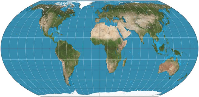
@Equal Earth Projection
Who opposed it
Not all countries welcomed the resolution. The United States, needless to say, opposed the text, judging it not as a simple cartographic update, but as part of a broader political and ideological project, criticizing in particular the references to reparations and the so-called “cognitive justice”.
The position of Ukraine is more nuanced, stating that it shares the goal of correcting historical distortions to the detriment of Africa and the Global South, but has raised doubts about the way in which some Equal Earth maps represent the Ukrainian territories occupied by Russia.
Kiev warned that, without adequate safeguards, adopting these projections could create ambiguity over the disputed borders.
