
As summer bequeaths us scorching oceans, seasonal patterns begin to herald, for Europe, the advent of an unstable winter, marked by one of the most intense El Niño events ever recorded. The forecasts come from the two main continental meteorological calculation centers: the ECMWF, the European Center for Medium-Range Weather Forecasts, based in Reading, and the UKMO, the British Met Office, the reference point for seasonal projections in the United Kingdom. According to the analysis released by Climate Impact Company on 11 September, the peak of the phenomenon is expected between December and February, with surface temperature anomalies in the equatorial Pacific which in some areas have already exceeded 6°C above normal.
What does “Super” El Niño mean
El Niño is the anomalous warming of the surface waters of the equatorial Pacific, a natural phenomenon that repeats every 2-7 years and influences the climate of half the world. It becomes “Super” when this temperature anomaly consistently exceeds 2°C above average for several consecutive months: a threshold reached only on three occasions from 1950 to today. According to meteorologist Andrej Flis, the ongoing event has already exceeded this threshold, and ECMWF projections indicate that ocean temperatures could rise up to 3°C above normal in the dead of winter. The higher this anomaly, the more energy and heat is pumped into the atmosphere from the Pacific—a surplus that alters global-scale pressure and, consequently, the location of the jet streams that drive weather over Europe and North America.
Less snow on the plains, more at altitude
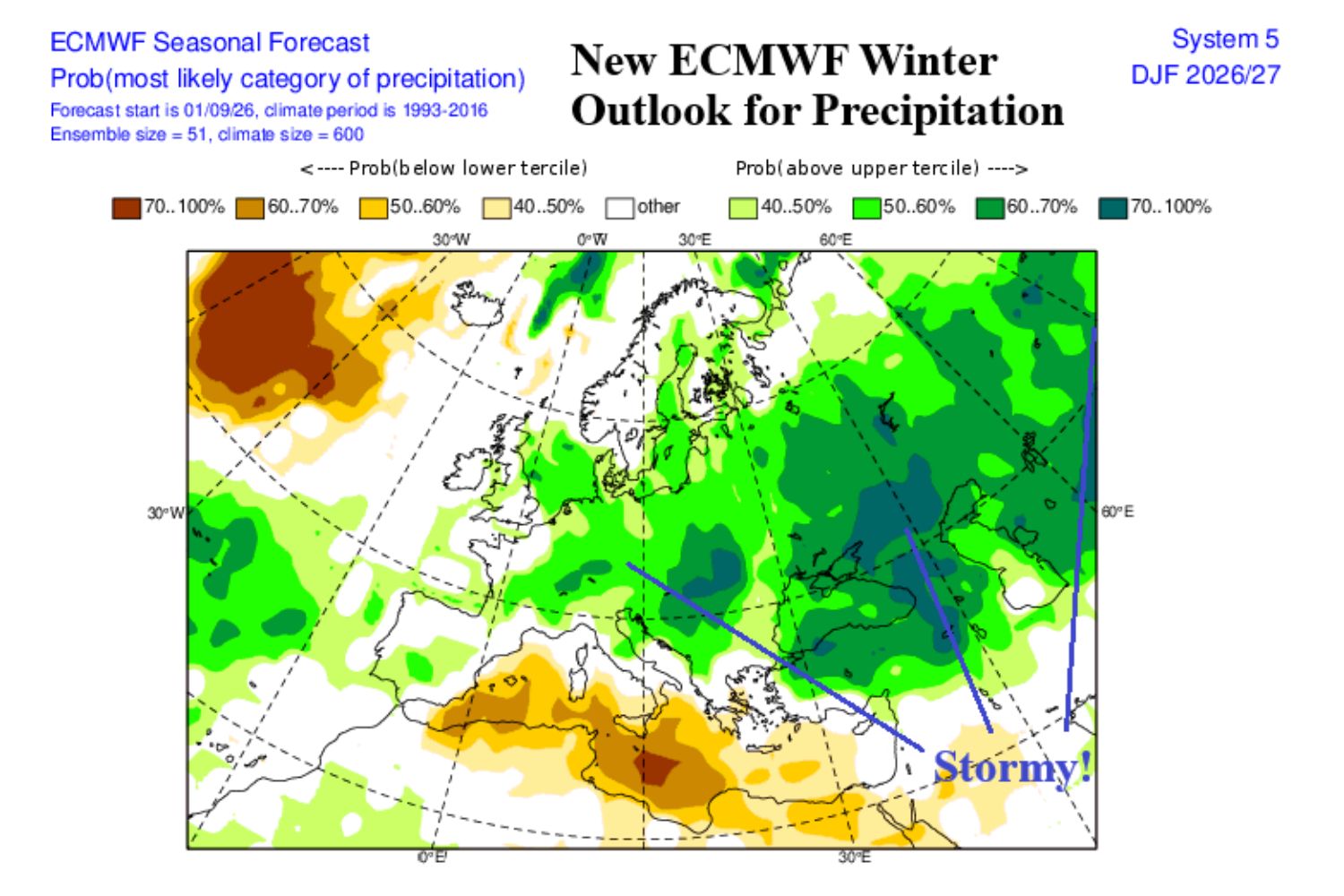
For the continent, the two centers converge on a picture that is anything but obvious: in most of Europe, snowfall will be lower than the seasonal average, thanks to a milder Atlantic westerly flow that will bring abundant rainfall but high temperatures. The deficit will mainly concern the central, western and southern regions, while exceptions will be made in Alpine altitudes above 1800-2000 meters and in the northern and north-eastern areas, where the snow could instead be above normal, especially in western Russia.
@ECMWF
The risk of a sudden Arctic irruption
However, the picture is neither static nor uniform throughout the season. The most recent simulations report the formation of anticyclonic blocks between Iceland and Greenland, a configuration that historically favors descents of Arctic and Siberian air towards the middle latitudes. It is the same mechanism that can weaken the polar vortex to the point of compromising its stability: when this happens, the freezing air normally trapped above the North Pole flows southwards, with possible cold waves capable of also affecting the Mediterranean basin and Italy, despite the snow deficit expected in the medium season.
The energy unknown
The most delicate issue concerns infrastructure. After years of mild winters that have partly masked the fragility of gas supplies to the continent, a prolonged cold wave would cause demand for heating to surge at a time when European supplies remain affected by tensions on international supply routes. In this scenario, the risk of localized blackouts cannot be ruled out if electricity demand exceeds the capacity of the networks during peak winter consumption. There remains a physiological margin of uncertainty for forecasts several months away. But the convergence between European and British models, combined with ocean data already observed, makes it difficult to archive this winter as a season like the others.
