
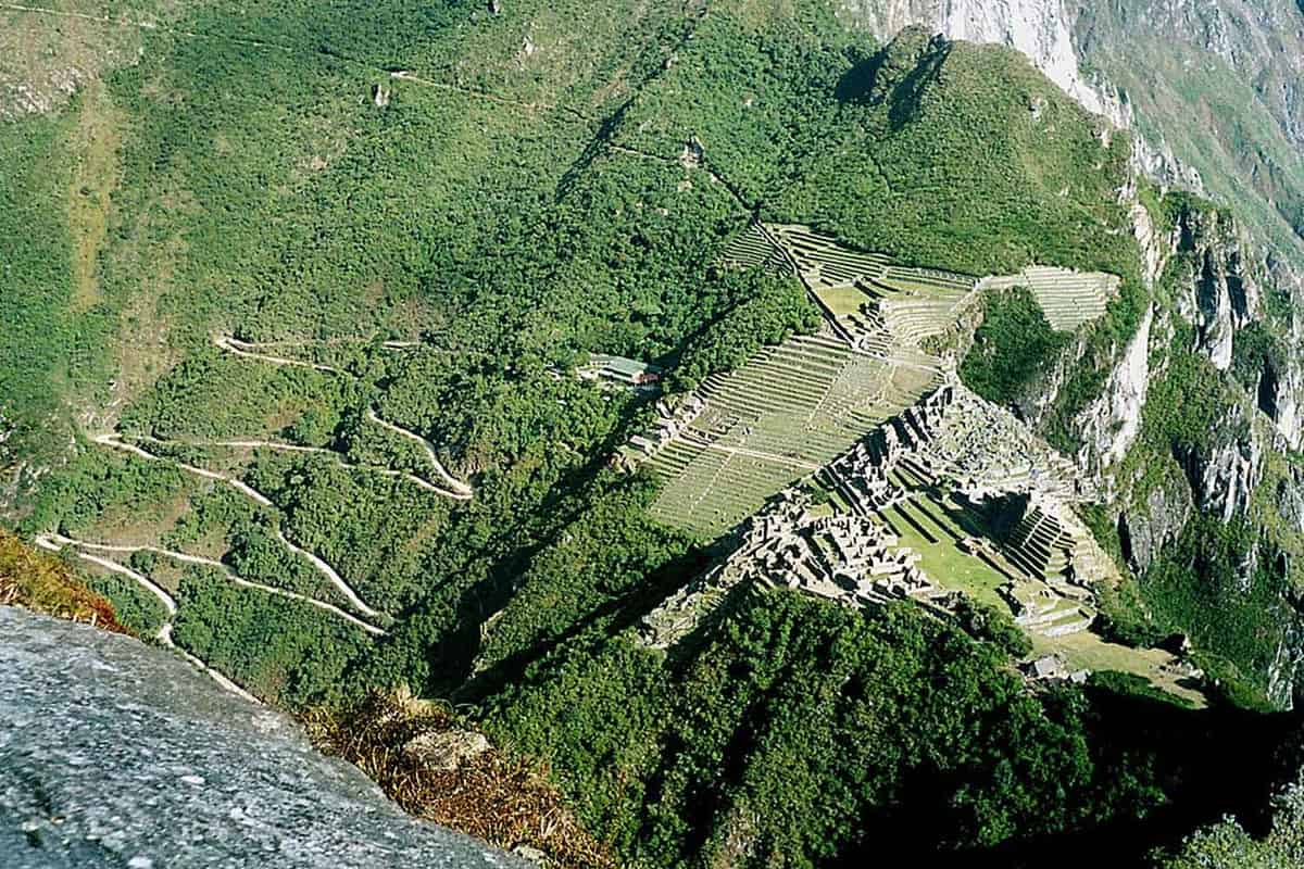
Three hours to travel just 250 meters. This is what it took for a group of archaeologists to make their way through the dense vegetation of the Peruvian Andes, where a drone had already spotted something extraordinary: over 2.5 kilometers of ancient pre-Columbian pathswhich remained hidden for centuries right in front of the famous citadel of Machu Picchu.
The discovery, which occurred during a research campaign between July and August 2026, could add an important piece to the history of Peru’s most famous archaeological complex. The routes develop along the right bank of the Urubamba river, cross an area full of terraces and stone structures and seem to head towards Mount Yanantin, a 4,100 meter peak considered sacred in Andean culture.
They were identified by a team of Polish and Peruvian researchers, thanks to the collaboration between the Center for Andean Studies of the University of Warsaw, the Polytechnic University of Wroclaw and the cultural authorities of Cusco. The discovery was announced on August 10 by Peru’s Ministry of Culture.
The laser found a 1.2 kilometer long road under the forest
The main route measures at least 1.2 kilometers, is about two meters wide and climbs the mountainside with a series of zigzag curves, a solution used by the Incas to overcome the steep differences in height of the Andes. Secondary routes branch off from this road, while possible platforms, terraces and circular structures have been identified nearby. A system complex enough to suggest that this part of the territory was much more popular and organized than previously thought.
Credit for the discovery also goes to LiDAR, a technology that uses laser pulses to measure distances and reconstruct the surface of the ground. Mounted on a drone, the instrument allows you to collect information even where the vegetation is so thick that it almost completely hides what is under the trees.
In this case, as reported by the Wroclaw Polytechnic, the archaeologists obtained three-dimensional models of the territory and recognized a series of regular lines that followed the slopes of the mountain. The tricky part came later, when they tried to reach the walking routes. Heat, humidity and vegetation made it difficult to advance even a few meters. Yet, under that layer of leaves and roots, there remained traces of a road network that not even the inhabitants of the area knew about.
The Muralla de Mandor may have been a ritual road
Among the structures present in the area there is one that has long intrigued archaeologists: the so-called Muralla de Mandora long stone construction that crosses the mountainside for about a kilometre. In some places it reaches a height of two or three meters. Dimensions that had suggested a possible defensive function, as if it were a wall intended to protect a settlement.
But something doesn’t add up in this interpretation. According to Nino del Solar Velarde, responsible for the archaeological research of Machu Picchu for the Directorate of Culture of Cusco, no archaeological evidence attributable to conflicts that would have justified such a fortification has been found in the area.
Then there is the management of the structure. The Muralla de Mandor in fact follows an axis that points towards the top of the Mount Yanantinone of the sacred mountains surrounding Machu Picchu. Interviewed by the Peruvian public agency Andina, Del Solar Velarde explained that what is called the wall could have been an elevated ceremonial road, built specifically to reach a place of worship.
For the Incas, mountains had a meaning that went far beyond geography. The Apu they were considered protective spirits, sacred entities linked to nature, fertility and the balance of the world. Yanantin belongs to this spiritual landscape, along with other peaks such as Salkantay, Pumasillo and Putucusi. The orientation of the road could therefore have a religious significance, although further excavations will be necessary to understand its original function.
Machu Picchu was much more than an isolated citadel in the mountains
The discovery adds an important element to the knowledge of Machu Picchu, built in the 15th century and now recognized as a UNESCO World Heritage Site. Its terraces, stairways and stone buildings have become one of the most recognizable symbols of the Inca civilization. Yet, the citadel represented only a part of a much larger territory, made up of settlements, agricultural areas, ceremonial places and roads that crossed the mountains.
About 60 archaeological sites are known in the Machu Picchu National Archaeological Park. Many are located on the same bank of the Urubamba river where the citadel stands and this had led scholars to concentrate their research there above all. The new paths tell something different. As Professor Mariusz Ziółkowski, director of the Center for Andean Studies at the University of Warsaw, explains, the newly identified roads suggest that the opposite bank was also affected by important transformations during the Inca period.
Other settlements and cultivated areas may have existed here, connected to the citadel through a much more extensive network of routes than is known. There is also a practical question that archaeologists would like to clarify: if the two banks were part of the same system, where were the connections to cross the river located? The Incas were capable of building suspension bridges using woven plant fibers. However, few traces remain of these structures and identifying the ancient crossing points could help reconstruct the movements between the different settlements.
Archaeologists will return to dig, but the location of the paths remains secret
The research will continue with new surveys and checks on the ground. The group of scholars aims to complete the LiDAR scans and start partial excavations to understand how the paths were built and what function the structures identified in their vicinity had. Peruvian Culture Minister Alberto Beingolea Delgado has already announced the government’s support for the continuation of the investigation.
The activities planned between the end of 2026 and 2027 will have to obtain the necessary authorizations, as this is a protected area of particular naturalistic value. Meanwhile, archaeologists have decided to keep the exact coordinates of the finds confidential. A necessary precaution to avoid the arrival of improvised treasure seekers, capable of damaging structures that are still waiting to be studied.
Machu Picchu thus continues to surprise even after over a century of archaeological research. Its most famous buildings are visited every year by people from all over the world, while on the other side of the river there are still roads to travel, terraces to explore and perhaps an ancient path to a sacred mountain. For centuries the forest kept them hidden. Now archaeologists know where to look, even if it will still take several hours and a few machetes to reach them.
