
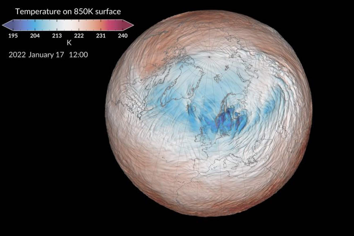
An exceptional atmospheric event occurred over the Arctic, about 30 kilometers above sea level. Between November 10 and 12, 2026, the stratospheric Polar Vortex experienced a sudden and marked weakening, accompanied by a reversal of winds that had not been observed so early in the season since 1958.
The phenomenon, known as Stratwarminghas already reignited hypotheses about a possible early arrival of frost in Europe. But does the collapse of the Polar Vortex really mean that December will be characterized by intense cold and snow in Italy too? The answer is less obvious than it seems.
What is the Polar Vortex
This is a vast circulation of winds that rotates around the North Pole, particularly intense during the winter, when the Arctic regions receive very little solar energy. In reality, two structures must be distinguished: the tropospheric vortex, which affects the lower layers of the atmosphere, and the stratospheric one, located tens of kilometers above sea level.
@NASA
The latter, when strong and compact, is characterized by powerful westerly winds surrounding a large area of very cold air over the Arctic. However, when it weakens, it can deform, move from its usual position or split, promoting changes in atmospheric circulation.
This does not mean, however, that the cold air automatically pours over Europe: a lot depends on what happens in the lower layers of the atmosphere.
What Stratwarming is and why November is record-breaking
The Stratwarmingor Sudden Stratospheric Warming (SSW), is a sudden warming of the polar stratosphere, where temperatures can increase by several tens of degrees in a few days. The phenomenon is generally caused by large atmospheric waves which, rising from the troposphere, disturb the circulation of winds around the North Pole.
In the most intense cases, defined Major Stratwarmingthe stratospheric winds that normally blow from west to east even reverse direction.
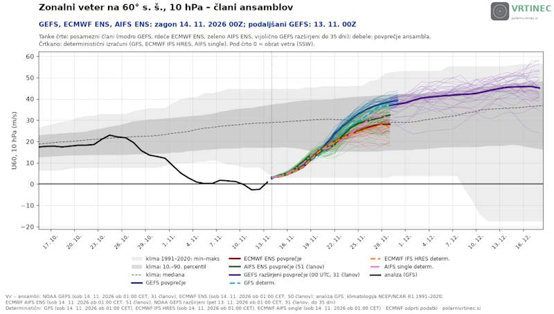
This is precisely what happened on November 10, 2026, when the winds at about 30 kilometers above sea level, at the latitude of 60° North, became easterly for three consecutive days. An extraordinarily early event: the previous record dates back to November 28th. This time the reversal came 18 days early. But there is one important detail: the disturbance was short and the Polar Vortex has already started to regain strength.
@VRTINEC
Will December be freezing?
The connection between Stratwarming and cold waves is not immediate. To concretely influence the weather in Europe, the stratospheric disturbance must propagate downwards, up to the troposphere, where the disturbances affecting our territory develop.
It is a process that can take several weeks and does not necessarily occur after every episode of stratospheric warming.
Weather model projections indicate a rapid strengthening of stratospheric winds between the end of November and the beginning of December, a sign of a progressive reconstitution of the vortex.
This reduces the hypothesis of a prolonged collapse, but does not exclude repercussions on European time. In fact, some simulations show the possibility that part of the disturbance reaches the lower layers of the atmosphere, favoring configurations capable of bringing colder air towards the middle latitudes.
For Italy, therefore, there is currently insufficient information to predict a December dominated by exceptional frost or widespread snowfall at low altitude. Colder phases remain possible, alternating with mild and disturbed periods, based on the evolution of the Atlantic currents.
The most important fact is that a record-breaking event in the stratosphere does not necessarily translate into extreme weather conditions on the ground. To really understand how the Italian winter will begin, we will need to observe the evolution of atmospheric circulation in the coming weeks.
Sources: Weather Met Office gov.uk
