
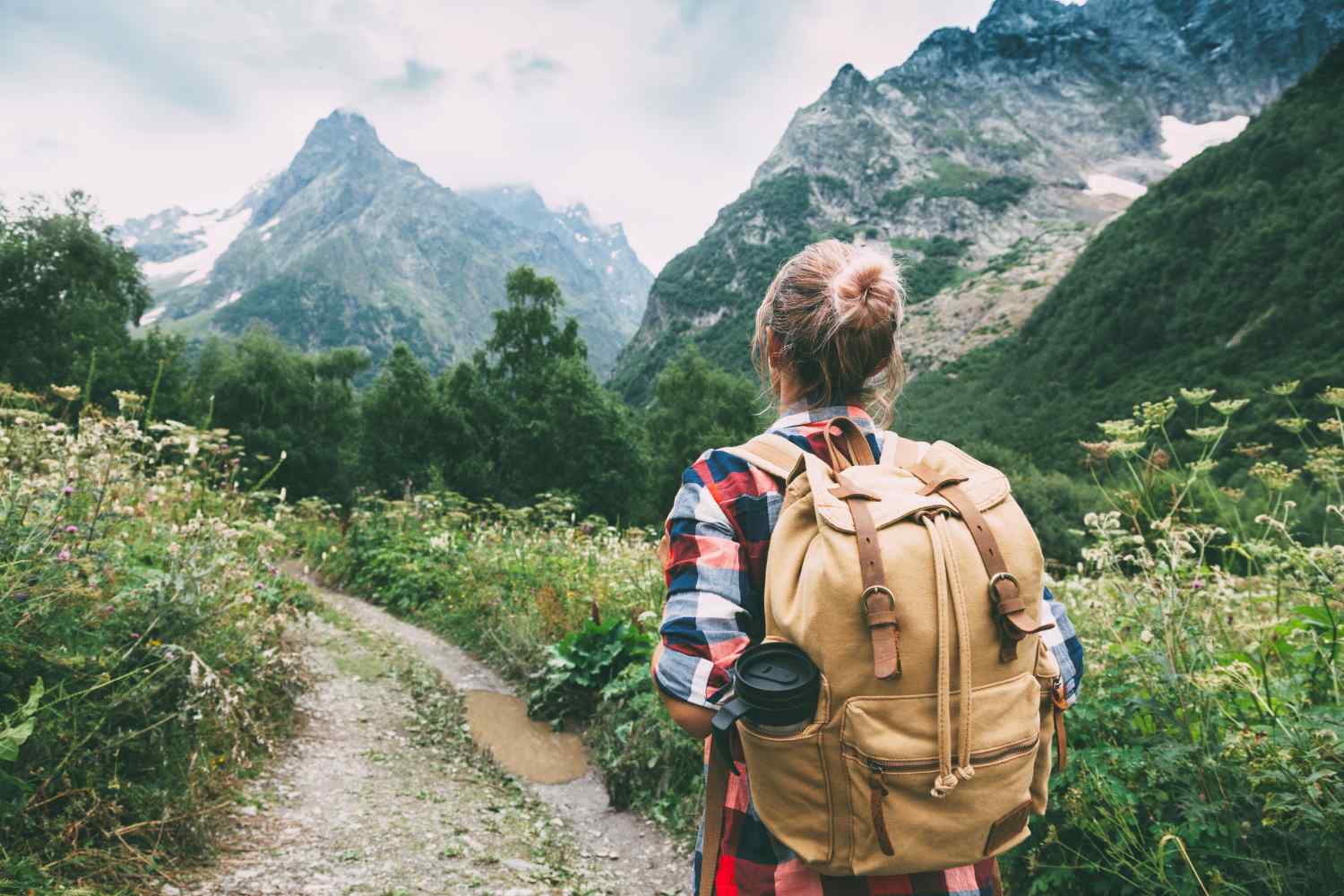
If you are looking for concrete ideas for walking in Campania, you are in the right place. Here you will find a selection of paths and walks suitable for those who want to be outdoors, move around nature and discover very different landscapes, even in winter. Volcanoes, sea, mountains, woods and waterfalls: all concentrated in a region that gives its best on foot.
We have collected routes of varying difficulty and duration, with clear indications on times, differences in altitude and characteristics, to help you choose the most suitable one. Whether you have a few hours or a whole day, want a panoramic walk or a more challenging excursion, here you will find reliable and already tested destinations where you can go without wasting time.
Great Cone of Vesuvius
The excursion to the crater of Vesuvius is among the most evocative in Campania and represents a unique experience for those who want to walk on an active volcano. The starting point is the square at Quota 1000 meters in the municipality of Ercolano, reachable by car. Various routes lead from here: the shortest route is a linear round trip along panoramic hairpin bends that cross expanses of scented broom, while the longest route allows you to make a loop passing through the Imbò refuge. During the climb you can admire Monte Somma with the Cognoli di Sant’Anastasia, Punta Nasone and a breathtaking view of the Gulf of Naples. Once you reach the crater, the spectacle of the deep mouth of the volcano, rich in colored minerals, lichens and some still active fumaroles, leaves you breathless. It is also possible to connect the square of Ercolano with that of Quota 1050 of Ottaviano.
Duration: 2h for the short route, 3h for the ring | Departure: Piazzale Quota 1000, Herculaneum
Hell Valley
Starting from Ottaviano, this spectacular trail crosses the Vesuvius National Park offering a unique and little-frequented experience. The route starts from the Medici Palace, headquarters of the Park Authority, and develops through a stone pine forest and a mixed forest of chestnut, Neapolitan alder and maple. After crossing expanses of scented brooms with a view of the lava dome from 1937, you descend into the true Valley of Hell, surrounded by majestic lava walls and spiers. Here it is possible to admire “rope” lava formations and spot rock birds such as the raven and the peregrine. The path then goes up the Cognoli di Levante, offering breathtaking panoramic views.
Difficulty: High | Length: 12.4 km return | Duration: 7h | Maximum altitude: 1000m
Punta Campanella
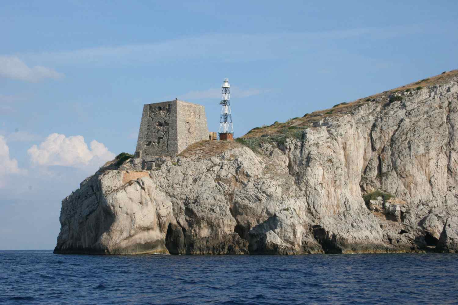
Starting from the characteristic square of Termini, a hamlet of Massa Lubrense and the last inhabited town towards the west of the Sorrento peninsula, this path offers unforgettable views of Capri and the Gulf of Naples at every step. From the small square, directly overlooking the island of Capri, follow the clear directions to take the CAI 300 path which crosses one of the most evocative landscapes of the Lattari Mountains.
The circular route first touches the church of Monte San Costanzo, offering a 360° view of the Sorrento peninsula, and then continues towards the splendid Bay of Ieranto, a natural area protected by the FAI. Walking on the southern side of the peninsula, the path – narrow and exposed at times – offers breathtaking views of the paradisiacal beaches and crystal clear waters below. The final descent, slightly more demanding due to the presence of large stones and some technical passages, leads to Punta Campanella, the closest point to Capri from the mainland. Here, between the ruin and the lighthouse, surrounded by the flight of seagulls and the roar of the waves on the rocks, you can experience an almost magical experience. The return takes place via a stone road that takes you back to Termini.
Difficulty: Mild | Length: 4 km | Duration: 2h return | Departure/Arrival: Termini (also reachable by bus from Sorrento)
The Path of the Gods
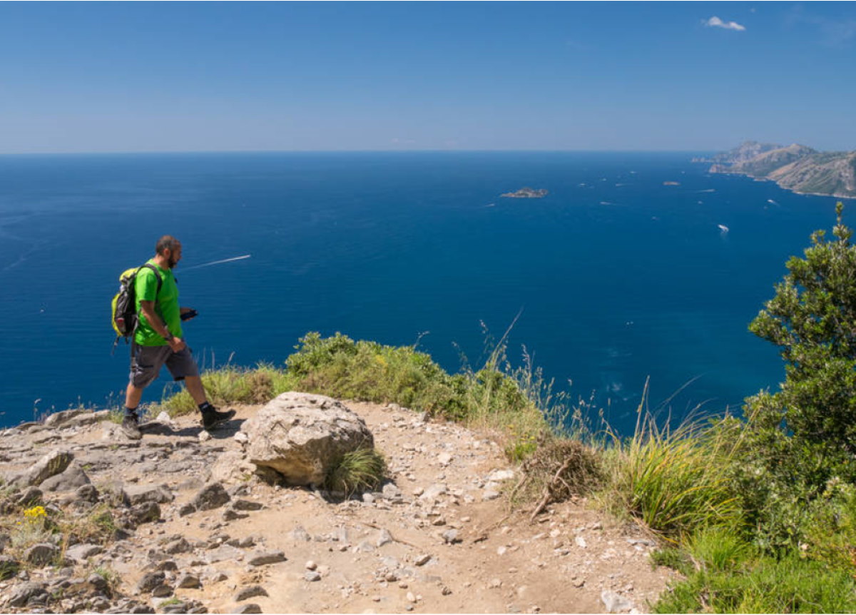
The Path of the Gods is one of the most famous and spectacular excursions in Italy, a route that crosses the Lattari Mountains on the Amalfi Coast preserving all the splendor of the splendor of ancient Greece. Italo Calvino himself described it as “that road suspended over the magical gulf of the Sirens still crossed today by memory and myth”, words that convey the magic of this place which has remained uncontaminated.
The path is divided into two variants: the Sentiero Alto, which starts from Bomerano di Agerola and ends in Santa Maria del Castello, also crossing a stretch that starts from Vico Equense, and the Sentiero Basso, the most famous and least tiring, which passes through Nocelle to get to Positano. The latter is almost entirely downhill and offers unforgettable views framed by the stacks of Capri, the Lattari Mountains, Monte Comune and Punta Penna.
Along the route you pass through stretches of breathtaking vegetation, fascinating caves such as the Grotta del Biscotto with its centuries-old houses, the Monte Serra Pass and the Vallone Grarelle with its waterfall and canyon. You can admire water springs and the splendid view of Li Galli island, where legend has it that mermaids sang to deceive sailors. Arriving in Positano you face the famous 1700 steps, while in Monte Pertuso you can observe the characteristic “pertuso”, the hole in the rock caused by the erosion of wind and water.
The route requires appropriate clothing with trekking shoes, light sports clothes, sun cream and hat. It is recommended for those who are used to walking and not recommended for those who suffer from vertigo.
Length: 10 km | Duration: 4-5h | Difference in altitude: 600m | Difficulty: Medium-easy | Departure: Bomerano (Agerola) | Arrival: Nocelle/Positano
Calabritto Waterfalls and Sanctuary of the Madonna del Fiume
View this post on Instagram
On the Picentini Mountains, in the Calabritto area, this route crosses an area rich in water with 14 waterfalls. The excursion goes up the Vallone del Lupolo stream, visiting the spectacular Bard’natore waterfalls, among the highest in Campania with a 70 meter difference in altitude distributed in five jumps. The path, immersed in an atmosphere of total peace, leads to the suggestive rock church of the Madonna del Fiume, inserted in a 17th century karst cave. Along the way you can admire small canyons and impressive rock formations.
Difficulty: Hiking (E) | Duration: 2h 30min | Difference in altitude: 400m
Monte Magnone: sunset on the Laceno plateau
View this post on Instagram
On the Laceno plateau, in Bagnoli Irpino, Monte Magnone (1361m) probably offers the most panoramic view in the area. 70% of the trail is on a comfortable dirt road that passes through woods and offers glimpses of Lake Laceno. The final, more challenging climb leads to the large cross at the summit where you can watch breathtaking sunsets over the Bagnoli valleys. A perfect excursion for lovers of twilight lights, to be tackled with a headlamp for the return.
Difficulty: Tourist (E) | Length: 9.6 km return | Duration: 3h | Difference in altitude: 350m
Mount Terminio
View this post on Instagram
Monte Terminio (1806m) is the second highest peak in the Picentini area after Monte Cervialto. The excursion starts from the Piccolo Ranch, a riding school with picnic area, and initially develops on a dirt road that crosses beech woods with three large hairpin bends. The actual path, which requires attention due to poor signage, climbs steeply through the woods until it reaches the summit, where there is a radio repeater. From the top, on clear days, you can enjoy a wonderful view of the Gulf of Salerno and Vesuvius. The use of GPS and trekking poles is recommended.
Difficulty: Hiking (E) | Length: 10 km return | Duration: 3h 45min | Difference in altitude: 540m
Matese Park: the fairy trail
In the Matese Regional Park there is a truly special route that starts from Gallo Matese. The path climbs through woods and rock formations until it reaches a fairy-tale plateau where a small lake, fed by a branching stream, creates an almost enchanted atmosphere. Here, surrounded by green mountains and typical mountain fauna, you reach the Fontana dei Palombi with its characteristic nine centenary basins.
Difficulty: Tourist (E) | Duration: 3h 30min | Difference in altitude: 500m