
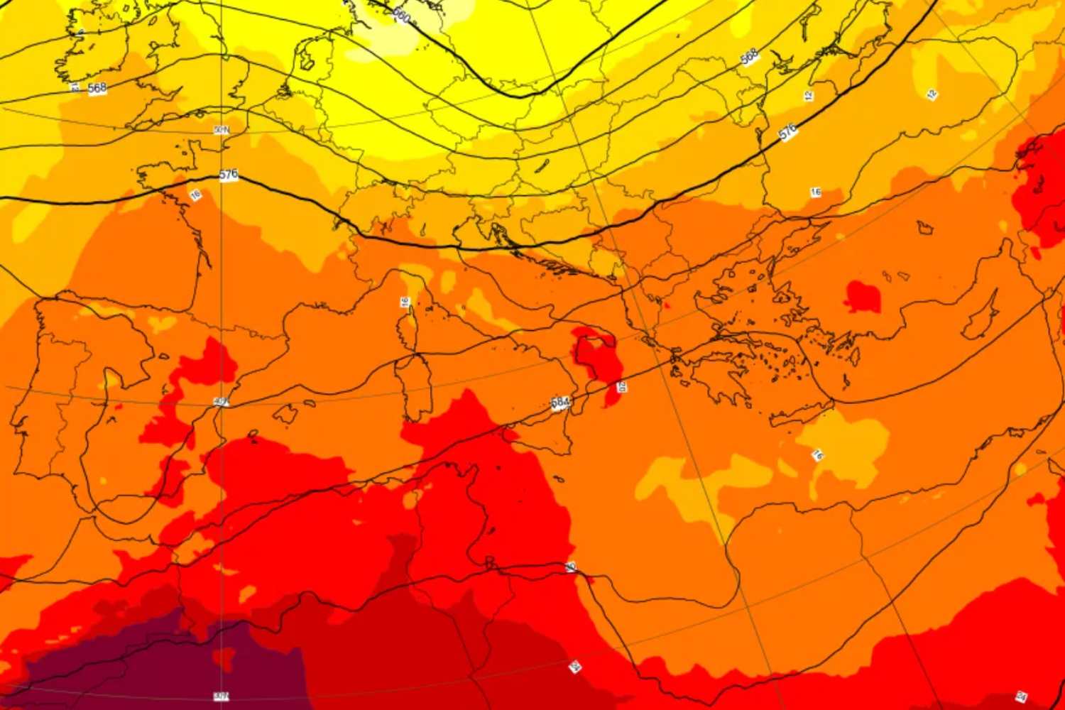
After the last blows of atmospheric instability, the meteorological situation in Italy is about to undergo a turning point. The disturbed currents will quickly abandon the country, leaving room for the advance of an extreme heat wave.
Already from Friday 12 June the improvement will be tangible in all regions, with large clearings and mercury columns ready to exceed the threshold of 28-30°C. This will be the prelude to a purely summer weekend, dominated by the expansion of the African anticyclone over the central-western Mediterranean basin.
This gigantic mass of hot air originates in the deep heart of the Sahara desert, where solar radiation overheats the rocks and atmospheric compression crushes the air downwards, activating a real subtropical heat pump capable of covering the entire peninsula.
The map of the blaze: here are the hottest areas
The first real seasonal flare-up will take place between Saturday 13th and Sunday 14th June, distributing the intensity of the heat in a targeted manner across the national territory. If the northern plains will record a solid summer blaze with highs stuck at 32°C, the main target of the Saharan air will be the Centre-South and the Major Islands.
Specifically, thermometers will rise dramatically in the internal areas of Sicily and Sardinia, territories that will be the first to record peaks of 33-34°C in the hot hours of the afternoon. The Tyrrhenian side, the internal valleys of Tuscany, Lazio and the flat sectors of central-northern Puglia will also rank at the top of the list of the hottest places in Italy, experiencing heat rates typical of July.
Long-term trend: there is a risk of peaks above 35 degrees
Medium-term heat projections indicate that atmospheric stability will not end with the end of Sunday. The action of the North African promontory, analyzed by meteorologist Mattia Gussoni and confirmed by Colonel Mario Giuliacci, suggests that the first African heat wave in June could even intensify over the following week.
The constant influx of warm subtropical air masses threatens to cause thermometers to make a further leap forward, pushing maximum values above the threshold of 35°C in several areas of the Centre-South. This scenario will constitute a real seasonal climate anomaly, decreeing the official start of an early summer.
You might also be interested in:
