
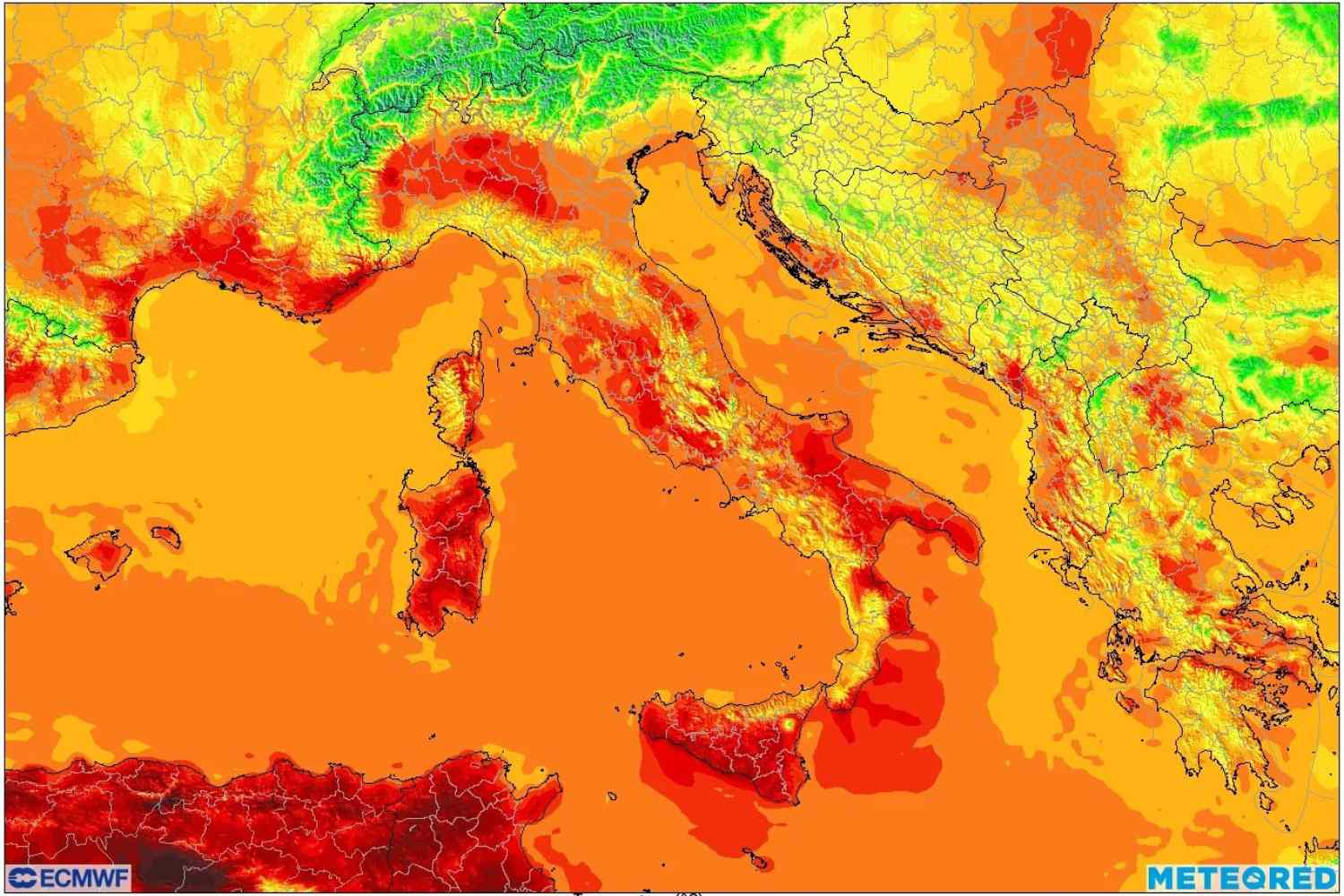
After days of intense heat, Northern Italy was hit by a violent worsening of the weather. On Wednesday 15 July a vast mesoscale convective system (MCS) crossed Piedmont, Lombardy, Emilia-Romagna and part of Veneto, causing strong thunderstorms, wind gusts exceeding 100 km/h and widespread damage.
According to the findings of the Emilia Romagna Meteo and Meteonetwork networks, the gusts reached 127 km/h in Monticelli, in the province of Parma. The bad weather caused downed trees, torn roofs, flooding and very intense rainfall, with accumulations exceeding 60 millimeters in less than an hour in some areas.
These are phenomena that experts increasingly link to the so-called “hot weather”: the energy accumulated in the atmosphere during heat waves in fact favors the formation of particularly violent thunderstorms when cooler air arrives.
@meteored
Still intense heat at the weekend
According to meteorologist Luca Lombroso of Meteored Italia, between Friday 17 and Saturday 18 July the heat will continue to affect a large part of the country.
Maximum temperatures will reach:
Along the coasts the heat will be slightly lower, but the heat will remain high, especially during the night hours.
In the meantime, the North will once again have to deal with instability: locally intense thunderstorms could develop as early as Saturday afternoon, in particular between Veneto and Emilia-Romagna, with possible hailstorms and strong gusts of wind.
Traffic changes from Monday
The atmospheric situation is expected to evolve at the beginning of next week. The formation of an anticyclone over the North Atlantic will favor the descent towards Italy of cooler air of maritime polar origin, resulting in a significant drop in temperatures especially in the North and along the central Adriatic side.
Sunday will be a day of transition: cloud cover will increase in the North and the first storms will affect the Alps and part of the Po Valley, while the Centre-South will continue to deal with high temperatures and skies often veiled by Saharan dust.
The most marked change is expected on Monday, when showers and thunderstorms will affect the North-East and central Adriatic regions. Meteorologists do not rule out the formation of new organized convective systems, potentially capable of generating cloudbursts, hailstorms and strong gusts of wind.
On the contrary, Tuscany, Lazio, Sardinia and especially Sicily will still remain under the influence of the very hot air coming from North Africa, with values close to 40 °C even in some coastal locations.
A brief respite from the heat
From Tuesday the cooler air should progressively extend to much of the peninsula, bringing temperatures back to values closer to seasonal averages: between 28 and 30 °C in the North and between 30 and 34 °C in the Centre.
The decrease in heat, however, could be accompanied by a new phase of instability, especially along the Adriatic side.
According to current projections, summer is not destined to end: towards the end of the month, new heat waves could in fact return, even if at the moment they do not seem to reach the intensity of those recorded in recent weeks.
