
The scorching heat gives us a brief respite, but a new blaze awaits us. After the peaks above 45°C recorded in inland areas such as Sicily, an African heat wave should affect our peninsula in the first days of August, with the Centre-South once again under pressure. This situation is clearly visible in the Meteored map, created on the basis of the latest calculations by the European Center for Medium-Term Forecasts (ECMWF):
@METEORED
A new African anticyclone in sight
ECMWF weather maps show the possible expansion, already from the first days of August, of a robust subtropical anticyclonic promontory from the Sahara towards the central Mediterranean. This scenario, which could occur between 2 and 3 August, would favor conditions of prolonged atmospheric stability and a significant increase in temperatures, with values higher than the seasonal average by up to +2/+3°C over much of the country.
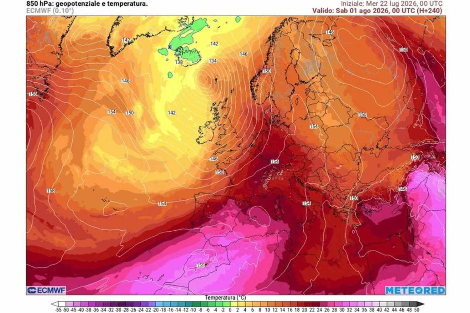
@ECWF
The areas most affected would once again be Sardinia, Sicily, but in general Central and Southern Italy, where temperatures could easily reach and exceed 35-38°C, with peaks above 40°C in the internal areas and southern plains. The heat will make the situation even worse, also fueled by the high temperatures of the Mediterranean Sea. The result will be widespread “tropical nights”, with high minimum values and little relief even after sunset.
Central-South in the grip of heat, instability in the North
One of the most interesting elements of the ECMWF projections concerns the different meteorological evolution between the various areas of Italy. While the Centre-South and the Islands could remain under the influence of the African anticyclone for much of the month, Northern Italy should experience a more variable and dynamic phase.
The arrival of cooler currents from the Atlantic could in fact favor the passage of disturbances and infiltrations of more unstable air at high altitude, increasing the risk of even intense thunderstorms. The contrast between the humid heat present in the lower layers of the atmosphere and the cooler air at high altitude could create the ideal conditions for violent phenomena, with possible hailstorms, strong gusts of wind and localized storms.
A typical situation of the summer transition phases, when the energy accumulated by the heat can quickly transform into extreme meteorological events.
A summer marked by climatic anomalies
The scenario forecast for August fits into a broader context: a summer of 2026 characterized by persistently above-average temperatures and a particularly hot Mediterranean. The ECMWF projections, although they may undergo changes in the coming weeks, show a fairly consistent signal in the different calculations:. As anticipated, the intense heat could continue to mainly affect the Centre-South, while the North could alternate cooler periods with potentially dangerous thunderstorm episodes.
Experts therefore urge caution, especially in the central-southern and island regions, where it will be important to adopt preventive behavior against extreme heat. In the North, however, it will be essential to monitor the evolution of short-term forecasts due to the risk of intense storms, after the episodes that have already caused damage and inconvenience in recent days.
