
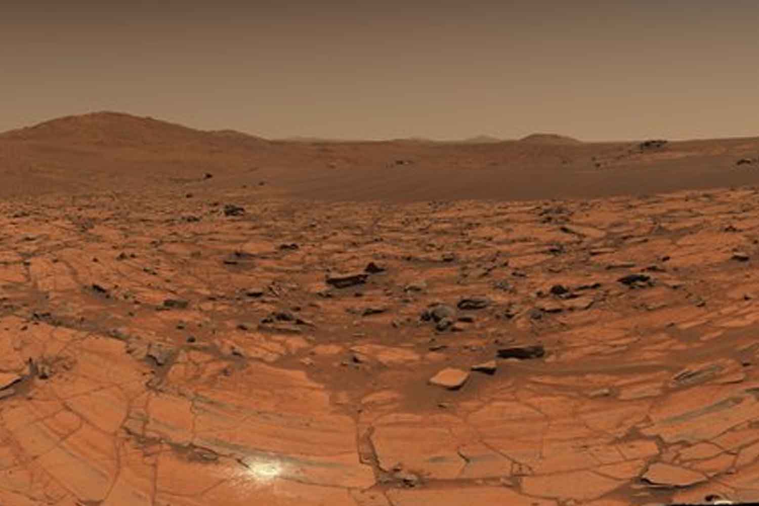
Perseverance stopped at a point called Falbreenhe rotated his gaze over the landscape and collected enough images to build a Mars that almost makes you want to walk. The 360 degree panorama, published by NASA on August 6, 2025was born from 96 photographs taken on May 26 of the same year by the rover’s Mastcam-Z. The result is one of the clearest views obtained during the Perseverance mission: rocks a few meters away, sand waves and hills visible up to 65 kilometers away.
The sky also did a good part of the work. The Martian atmosphere that day contained relatively little dust, and visibility was unusually good. Mars, when he decides to collaborate with the photographer, can be quite photogenic.
96 images to look at Mars up to 65 kilometers
The photographs were collected during 1,516th Martian day of the missionthe so-called sol. Perseverance was now far from where it began its journey in February 2021, on the floor of Jezero Crater, and had reached the top of the crater rim in late 2024.
By putting together the 96 images, the Mastcam-Z team obtained a mosaic in which the depth of the landscape can be read almost in layers. Flat, light rocks appear near the rover, further away the ground changes color and consistency, while in the background reliefs tens of kilometers away emerge.
A line crosses a good part of the panorama and marks the passage between two different geological units. The lighter rocks near Perseverance are rich in olivine; the darker and more distant ones instead seem to contain clay minerals and could be decidedly older. Falbreen is of particular interest to researchers for this reason: according to the mission team it could be inside some of the oldest terrain ever explored by the rover, perhaps even preceding the formation of the Jezero crater.
The strange rock resting on the sand
In the midst of so much geology there is one that seems to have settled in the wrong place. Approximately 4.4 meters from the rover you can see a large dark rock apparently resting on a small crescent-shaped ripple of sand. Geologists call it one float rock: a rock that probably formed elsewhere and was transported to the location we see it today. How it got there remains uncertain. Among the possibilities considered are a landslide, water or wind.
The high-resolution image published by the Jet Propulsion Laboratory also allows you to observe the traces left by Perseverance’s wheels. About 90 meters from the shooting point they bend to the left and disappear in the direction of a previous geological stop called Kenmore.
©NASA
A small, almost white circle appears in the ground just to the left of the center. This time Mars has nothing to do with it: Perseverance did it.
It’s the 43rd abrasion point made by the rover since the beginning of the mission. The blob measures just 5 centimeters and was drilled on May 22, 2025, four days before the panoramic images. Removing the surface layer altered by dust and atmospheric agents allows the instruments to analyze the cooler rock underneath and allows researchers to decide whether to take a sample if necessary.
That almost blue sky is beautiful, with one small clarification
In the most spectacular version of the panorama, the Martian sky appears surprisingly clear, with shades approaching blue. However, NASA published it two different processes of the same scene.
The one with the most intense colors was processed by increasing the chromatic contrast, precisely to make the differences between the various rocks and the sky more recognisable. It is therefore extremely useful for reading the landscape, as well as quite impressive to look at. In the natural-color version, however, the sky retains the much more familiar reddish hue associated with Mars.
The clarity of the panorama, yes, comes from the conditions encountered by the rover. Jim Bell, science lead for Mastcam-Z at Arizona State University, explained that the relatively small amount of dust suspended in the atmosphere allowed it to see much further into the surrounding landscape.
And this is perhaps what makes Falbreen so special. The route already taken by the rover ends in a single image, a rock that came from who knows where, terrain that could precede the Jezero crater itself and mountains 65 kilometers away. Mars remains tens of millions of kilometers from Earth, but for 96 photographs it appears to have gotten quite close.
