
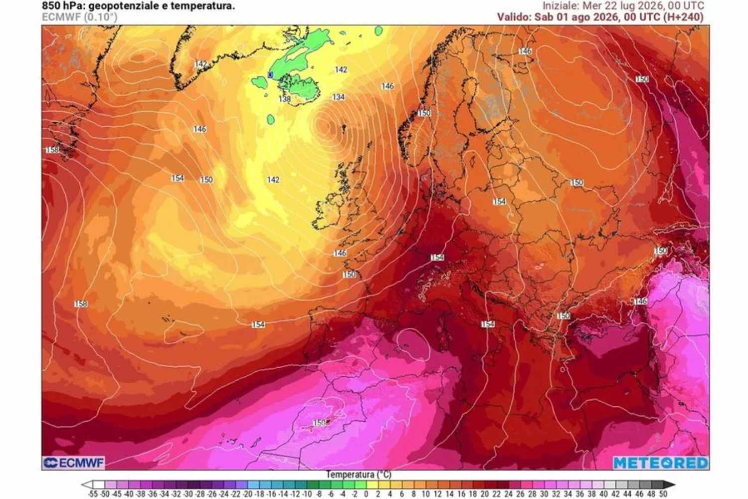
Forty degrees in August is the forecast that emerged from the latest updates of the meteorological models, which confirm the presence of a subtropical anticyclone in Italy destined to dominate the scene at least until the weekend of August 15th. The week opens with a brief stormy respite in some areas of the country, where showers and, in some cases, hailstorms have been recorded in the last few hours. An interlude which, however, will soon give way to a new, robust pulsation of the African bubble, with a mass of hot and dry air arriving directly from the internal regions of the Sahara.
From Monday the weather remains mostly stable and sunny. Maximum temperatures, initially between 32 and 38 degrees, rise further in the middle of the week to reach 36-39 degrees in the internal and flat areas, with peaks locally close to 40° C. Rome, in particular, should reach close to 39 degrees: a value that certifies, if anything were still needed, how anomalous the summer of 2026 was. In the Po Valley and along the coasts the heat becomes feel more than elsewhere, while the minimums remain high almost everywhere, with the now familiar tropical nights making it difficult to rest. There will be no shortage of heat storms, concentrated above all on the Alps, Pre-Alps and the Apennine ridge, with some occasional spillovers towards nearby plains and coasts. The high energy in the atmosphere could make them locally intense, so we can expect hailstorms, gusts of wind and violent showers, while remaining limited phenomena, incapable of affecting the general picture. The absolute protagonist, even on the day of the party, will still be the heat.
August 15th between sun and sultriness
For mid-August the forecasts converge on a scenario of mostly clear skies across the entire national territory, temperatures well above the seasonal average and marked sultriness. The highest values will be recorded in internal areas and on the plains, where peaks close to 40 degrees remain a far from remote hypothesis. The only variable remains that of afternoon thunderstorms in the mountains, which may be intense but will not be enough to interrupt the heat wave. The Ministry of Health, which publishes heat wave bulletins for 27 Italian cities every weekday from 25 May to 20 September, has already assigned the red sticker, i.e. the maximum alert level, to most of the monitored capitals, including Rome, in recent weeks. A picture which, according to the expected evolution, is unlikely to change in view of the August bank holiday weekend.
And after? The turning point remains a hypothesis
A clearing up, at least on the thermal front, could arrive between 17 and 18 August, starting from the northern regions: the entry of more temperate air from France would favor a drop in temperatures and greater instability in the North. In the Centre-South and on the Islands, however, the African heat risks lasting longer and for a clearer attenuation we will probably have to wait until the final part of the month. Experts, it must be said, urge caution, because there are still too many days left for the forecast to be consolidated, and it is not excluded that the African bubble will find a way to extend its stay even beyond mid-August.
