
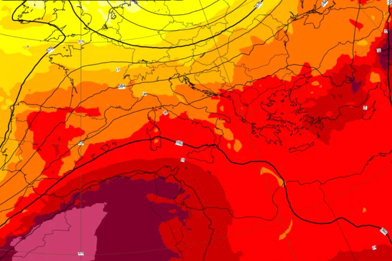
The weekend of 22 and 23 August 2026 will open under the banner of a gradual healing of the atmospheric wound that has recently crossed central-western Europe. On Saturday 22 August, the last offshoots of the disturbance will be felt during the morning hours with residual accumulations and rainfall localized in the Po Valley, in Liguria, along the eastern Alpine and pre-Alpine mountains, as well as in the internal areas of lower Lazio and Campania.
From the afternoon the meteorological situation will evolve towards a general improvement, with increasingly clearer weather across almost the entire country, except for residual variability in the eastern Alps which may cause isolated evening showers in Friuli. Temperatures will begin to rise in the Centre-North, reaching around 30°C in the Po Valley and exceeding this threshold in Romagna. In the south, although with values slightly decreasing compared to the extreme peaks of the previous days, peaks of 37-38°C will still be reached in the internal areas of Puglia, Ionian Calabria and Sicily.
Sunday 23 August: the peak of the improvement and widespread heat in the Centre-South
Sunday 23 August will see the temporary consolidation of the subtropical anticyclone, which will guarantee decidedly more stable and enjoyable weather conditions from north to south. The skies will be mostly clear or slightly cloudy over almost the entire peninsula, with large clearings especially in the North-West. The most important element will be the marked increase in temperatures which will also involve the northern regions, where the values will fully fall within the seasonal averages of the period. In the Centre-South and on the Major Islands, solar radiation will push thermometers widely above 34°C during the afternoon hours.
The only disturbing elements will remain relegated to the mountainous areas of the North, where slight afternoon thickening may develop in the Tuscan Apennines and sporadic showers by evening in the Dolomites, in a context that is still largely sunny in the rest of the nation.
The turning point at the end of August: new Atlantic front between Monday and Tuesday
The period of stability guaranteed by the African bubble, however, promises to be short-lived. Meteorological models confirm how the summer season is entering a structurally more dynamic and vulnerable phase. Starting from the night between Monday 24th and the early hours of Tuesday 25th August, a new and energetic Atlantic front will approach the northern regions, breaking the truce again and bringing showers and thunderstorms starting from Northern Italy. This continuous alternation between fast hot flashes and sudden unstable passages certifies the beginning of the seasonal decline, outlining a dynamic end of August without long-lasting high pressure structures.
