
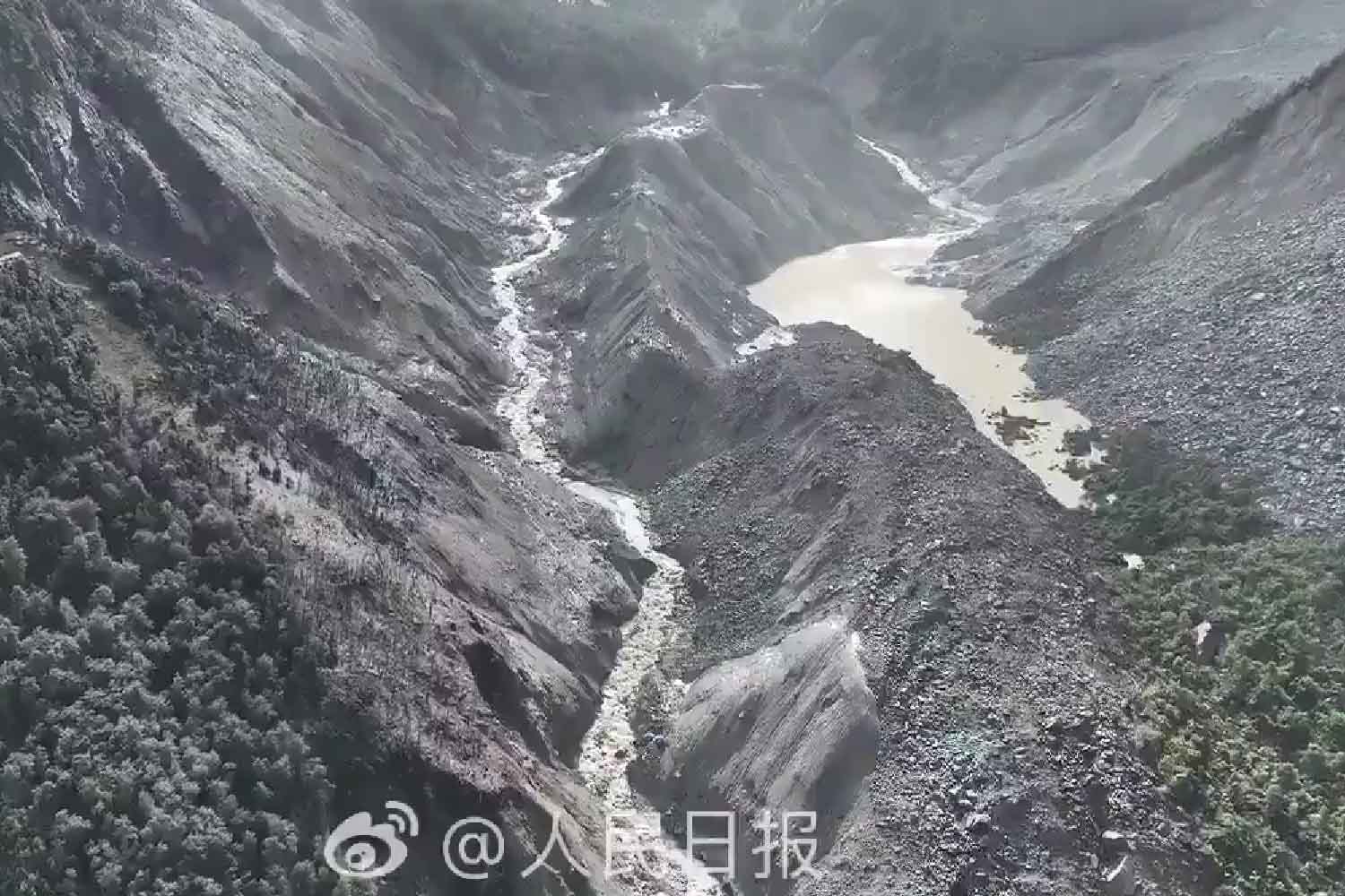
On the morning of August 26, seismographs recorded an earthquake signal in the Himalayas. Satellite images and wave analysis then put the sequence back in order: an enormous mass of ice and rock had broken off at high altitude, fallen for over a kilometer and made the ground tremble. The energy released by the landslide and debris flow was comparable to that of a magnitude 5.2 earthquake. From there began the wave that swept over the border between Nepal and Tibet, obliterating roads, bridges, houses and entire stretches of valley. The National Institute of Geophysics and Volcanology also clarified this.
The balance continues to change as you dig through the mud. At 7 am on August 28, the Nepalese police reported the recovery of 469 bodies in eight districts. On the Tibetan side, the latest official toll available spoke of three deaths and 558 people still missing. The different lists of residents, workers and travelers are updated hour by hour and do not coincide perfectly, but the people missing between the two sides of the border are now over 1,400.
View this post on Instagram
The earthquake was the landslide
The first reconstruction had attributed the disaster to a seismic shock. The opposite happened. According to INGV, the signal initially classified as a 4.4 magnitude earthquake was produced by the collapse of a huge block of ice and rock and the subsequent debris flow. More in-depth analyzes have estimated that the phenomenon has an energy equivalent to that of a 5.2 magnitude earthquake. The precise causes of the detachment are still being studied.
The most recent official reconstructions place the detachment on the Nepalese side, in the Langtang National Park area, near Tibet. The US Geological Survey speaks of a debris flow and a flood probably triggered by glacial collapse. Ice and rocks reached the Lhende Khola, dragging more material and water along the way to the Gyirong Tibetan crossing. The flood continued its course southwards for almost one hundred kilometres.
For some time debris also blocked the Lhende Khola. When that natural dam gave way, water, mud and boulders found a path already prepared by gravity. ICIMOD, the intergovernmental center that studies the Hindu Kush Himalaya, recorded an increase in water levels of up to nine meters in just thirty minutes on the Trishuli River in Galchhi; in Malekhu the increase was around seven metres.
Gyirong was hit directly
The flow reached Gyirong Port, in Tibet, one of the main road crossings between Tibet and Nepal along the route connecting Lhasa and Kathmandu. Within a few minutes the mud submerged buildings and infrastructure at the border post. The Tibetan authorities had brought the number of missing people on their territory to 558 already on the morning of August 27; among them were 260 foreign citizens.
Chinese Premier Li Qiang personally arrived in Gyirong on August 27 to monitor the operations. Beijing had mobilized rescuers, soldiers, helicopters, transport vehicles and drones to re-establish communications in an area where reaching some points already requires a lot in normal conditions. With kilometers of roads disappeared under the mud, normal conditions are a rather distant memory.
Also on the Nepalese side the devastation runs along the Bhote Koshi and Trishuli rivers. Nepal’s Foreign Ministry reported widespread damage to homes, roads, bridges and hydroelectric plants, as well as hundreds of foreign nationals yet to be traced.
Among the people who were still untraceable on August 27 there are also three Italians, according to updates from the Farnesina. A first official note from the Ministry of Foreign Affairs had reported checks on the names reported by the Nepalese authorities and the sending of personnel from the Italian Embassy in New Delhi to Kathmandu. The lists are particularly difficult to reconstruct because they include people headed for the crossing, people who may have already crossed it and travelers left without communications.
Now the lakes created by debris are scary
The wave of August 26 also changed the terrain it crossed. Debris blocked waterways and formed dam lakes on both sides of the border. The risk now is that the water pressure will break those dams made of mud, rocks and unstable material, releasing a second flood while rescuers and inhabitants are still in the devastated area.
On the Tibetan side, China’s Ministry of Water Resources estimated on Thursday about two million cubic meters of water had already accumulated in the reservoir near Gyirong. Forecasts indicate the arrival of another three million cubic meters over three days, with a high risk of subsidence and possible consequences for the pass and the areas further downstream. The authorities activated hydrological monitoring, satellite remote sensing and technical teams on site.
In the early hours of August 28, water began to overflow towards the search area. The operations in the most exposed point of Tibet were therefore suspended: the teams already advanced were moved back about a kilometer and put on hold in areas considered safer. The missing come first. Even before that, however, it is necessary to prevent rescuers from being added to their number.
Nepal has also issued an alert for communities and teams working along the Bhote Koshi and Trishuli, asking them to move away from the banks and reach higher areas. Rainfall forecast in the next few days may further increase the water retained by the new dams. The mountain, after having changed shape in a few minutes, therefore continues to move.
A barrier lake near the Nepal-China border is overflowing and could breach, Chinese authorities warn. It formed a day after flash floods killed hundreds in nearby communities. The lake held about 2 million cubic meters Thursday, with another 3 million expected within three days. pic.twitter.com/9I15tN3Tgb
— Open Source Intel (@Osint613) August 27, 2026
The climate enters history, with an important caution
Directly attributing this single detachment to climate change still requires studies: INGV specifies that the causes of the collapse remain under examination. The context of the Himalayas, however, is already measured with great precision.
According to a report published in 2026 by ICIMOD, between 1990 and 2020 the glaciers of the Hindu Kush Himalaya lost approximately 12% of their surface area and 9% of their estimated ice reserves. The pace of loss has doubled since the turn of the century. Warming, retreating glaciers and degradation of permafrost make slopes where ice and rock only stay together as long as they can, more unstable.
In Gyirong that stability lasted until the morning of August 26. Then a mountain mass plummeted more than a kilometer, shook instruments thousands of kilometers away and turned several streams into a mudslide. Now seismographs have stopped being the problem. It’s the water trapped in the debris that everyone is looking at.
