
Italy is preparing for a new phase of bad weather, with intense rain and thunderstorms especially in the Centre-North starting next week. After a mainly cloudy weekend but with little rainfall, the disturbances will return from Monday 9 November, accompanied by Scirocco and Libeccio winds.
According to the forecasts of Luca Lombroso, meteorologist of Meteored Italia, the worsening will be fueled by Atlantic currents and a atmospheric rivera flow of particularly humid air that will transport large quantities of water vapor towards the Mediterranean.
Despite the return of rain, temperatures will remain mild, with values above 20°C in several regions of Central and Southern Italy.
Weekend of 7 and 8 November: clouds, little rain and mild weather
On Saturday 7 November the sky will remain cloudy over much of the Peninsula, with light rain between Veneto and Emilia-Romagna and some showers between Calabria and Tyrrhenian Sicily.
On Sunday 8th, wider clearings are expected in the Centre-North and in the Alps, while precipitation will generally be absent.
Minimum temperatures will drop slightly, up to 4-6°C in the Po Valley and in the internal areas of the Centre, without significant frosts. Maximum temperatures will reach 12-14°C in the North, around 18°C in the Center and values close to 20°C in the South.
From Monday 9 November the rains return
Cloud cover will increase on Monday 9th and Tuesday 10th November, with the first drizzle in the North followed by more widespread rainfall over the Po Valley, along the Apennines and in the central regions.
In the South the rains will mainly affect Campania and northern Puglia. More sunny spells are expected in Sardinia, Sicily and along the Adriatic coasts.
Temperatures will remain around 12°C in the North, while in the Centre-South the arrival of warmer air will bring the maximum to 18-20°C, with peaks of up to 25°C on the major islands.
San Martino, 11 November: rain in the Apennines and snow at high altitude
On Wednesday 11 November the weather will remain unstable, especially in the Apennines exposed to south-western currents and in the western Alps, where snowfall is expected at higher altitudes.
Clear weather is expected in the central-eastern Alps, while Sardinia and the Tyrrhenian regions will be affected by Scirocco and Libeccio winds. Generally light rainfall in Lazio and Tuscany, with drier and milder conditions in the South.
Thursday 12 November: risk of heavy rain and strong thunderstorms
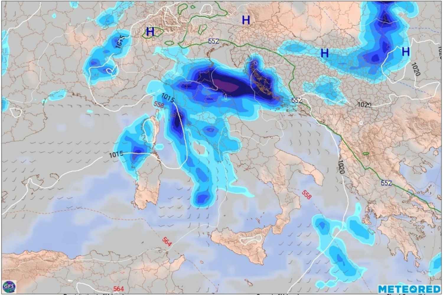
The most significant deterioration is expected from Thursday 12 November, especially from the afternoon and evening.
Precipitation could become persistent between Liguria, upper Tuscany and western Emilia, with accumulations exceeding 100 millimeters in the most exposed areas. Intense thunderstorms are also possible in central regions.
In the South the rain will mainly affect part of Campania, while showers are expected in Sardinia.
Temperatures will rise further: maximums of 15-16°C in the North, up to 20°C in the Center and 24°C in the South. In Sicily they could reach or exceed 26°C.
In the Alps the freezing point could reach up to 3,000 metres, limiting snowfall to the highest altitudes.
The most delicate phase will therefore be Thursday, although the intensity and distribution of rainfall will need to be confirmed with the forecast updates for the next few days.
