
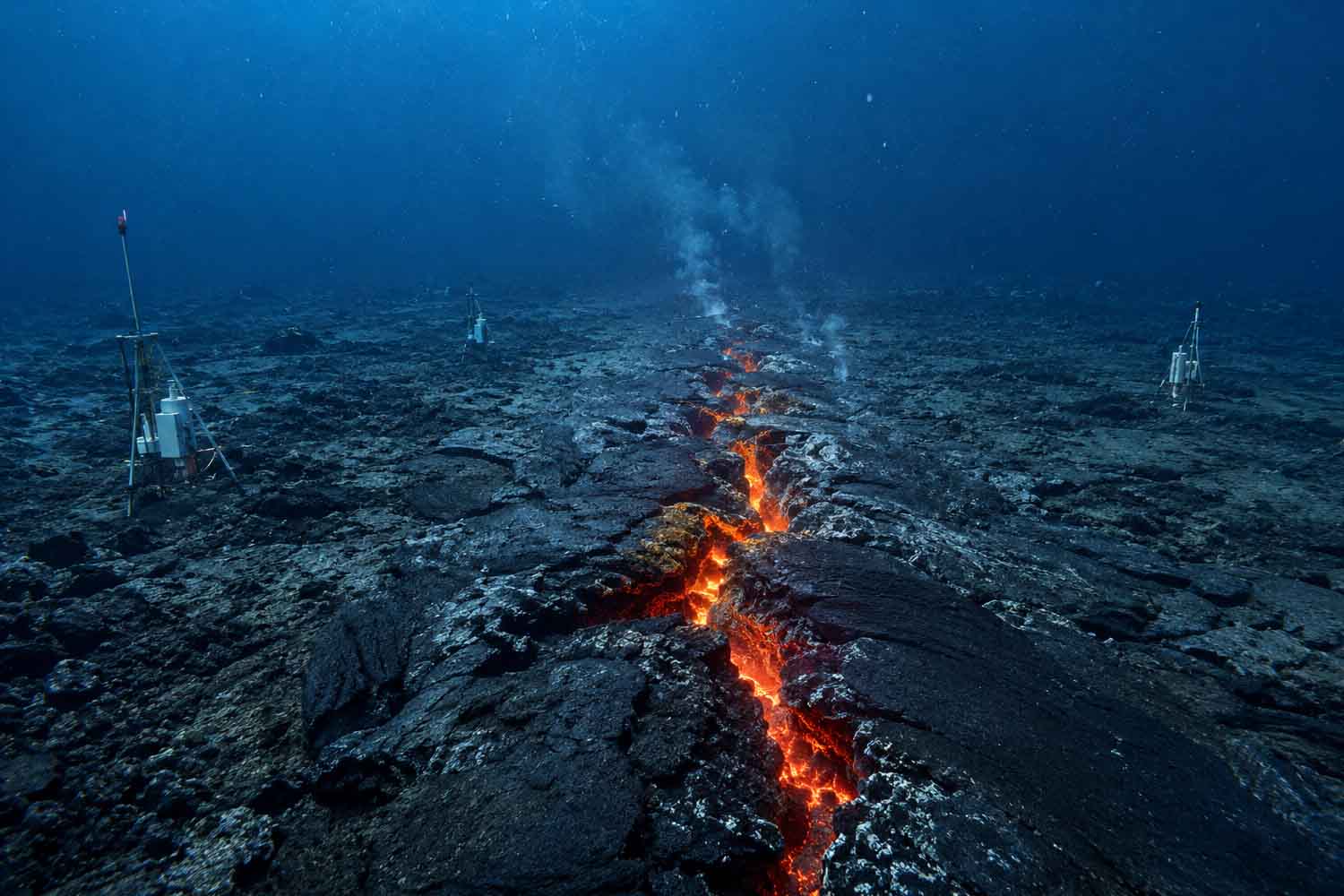
At the bottom of the Indian Ocean the instruments had been placed just two months ago. Then, on the evening of April 26, 2024, the ground began to sink, the walls of the underwater valley moved away, and magma forced its way through the crust. The researchers found themselves faced with a process that until now they had been able to reconstruct especially after it had already occurred: the formation of a new stretch of oceanic crust.
The event occurred along the Southeast Indian Ridge, the submerged mountain range that separates the Australian plate from the Antarctic one. It lasted sixteen days and was followed through hydrophones, pressure sensors, acoustic measurements, earthquakes and new maps of the seabed. The results were published in a study on Nature.
Under ordinary conditions, the two plates move apart by just over six centimeters per year. During the most intense phase, the ridge opened at a speed close to five centimeters per minute.
The magma broke through the crust in less than two hours
The sequence began with an earthquake swarm, followed by a 4.9 magnitude earthquake. The signals began to move along the submerged valley, first in one direction and then in the other. That movement followed the propagation of dykes, large vertical fractures into which the magma manages to slip. In less than two hours the intrusions traveled several kilometers, pushing the crust to the sides and changing the tension on nearby faults.
Under the ridge there was a magma reservoir about two and a half kilometers wide. As the magma rose, the reservoir partially emptied and the ground above lost support. The pressure sensor recorded a drop of 1.2 meters in approximately forty minutes. At the end of the event, some areas of the seabed had sunk up to 4.2 meters. Horizontal displacements reached values between two and four meters.
All this was happening thousands of meters deep, in a remote area of the ocean where seismic stations on land can locate an earthquake with errors of more than twenty kilometers. Without the instruments installed directly on the seabed, a significant part of the sequence would have remained blurry.
Up to 160 million cubic meters of lava
The magma reached the ocean floor and began to erupt. The hydrophones recorded thousands of short signals, produced by contact between the hot lava and sea water. The activity continued through three main impulses, from 26 April to 12 May. Between 148 and 160 million cubic meters of lava were emitted in that period.
Maps made after the eruption showed two large bands of new volcanic material. One extends for about four kilometers. In some places the accumulated lava exceeds ninety meters in thickness. One of the structures created during the event is located about six hundred meters from one of the instruments. Enough distance to measure almost anything, including water temperature rise, without losing the device under the pour.
This is how much of the ocean floor is formed. The hot material rises from the mantle, partially melts and feeds the reservoirs under the ridges. The magma enters the fractures, reaches the seabed and cools. Meanwhile, the plates continue to move away, dragging the already formed crust to the sides.
The global network of mid-ocean ridges extends for approximately 65 thousand kilometres. The process has been going on for millions of years, far from coasts and under columns of water that make it difficult to follow it as it happens.
A part of the ridge moved silently
The measurements also showed something that the earthquakes alone told poorly. Much of the movement of the faults occurred aseismically, without releasing an amount of energy commensurate with the meters of movement recorded.
The observed earthquakes explained only part of the opening of the ridge. The rest would have occurred through slow flows, favored by the pressure of the magma in the fractures and by the emptying of the underlying reservoir.
This detail helps to understand why seismic recordings have often returned a lower seabed expansion than that measured in the long term. Some of the movement occurs without shocks strong enough to be clearly detected by distant networks.
The intrusion also reactivated some nearby faults and produced other earthquakes, including a magnitude 5.9 event. Within a few days the reservoir deflated, the seabed sank, the valley widened and the lava covered a piece of the ocean. Now, down there, there is a crust that wasn’t there before April 26, 2024. And the instruments heard everything.
