
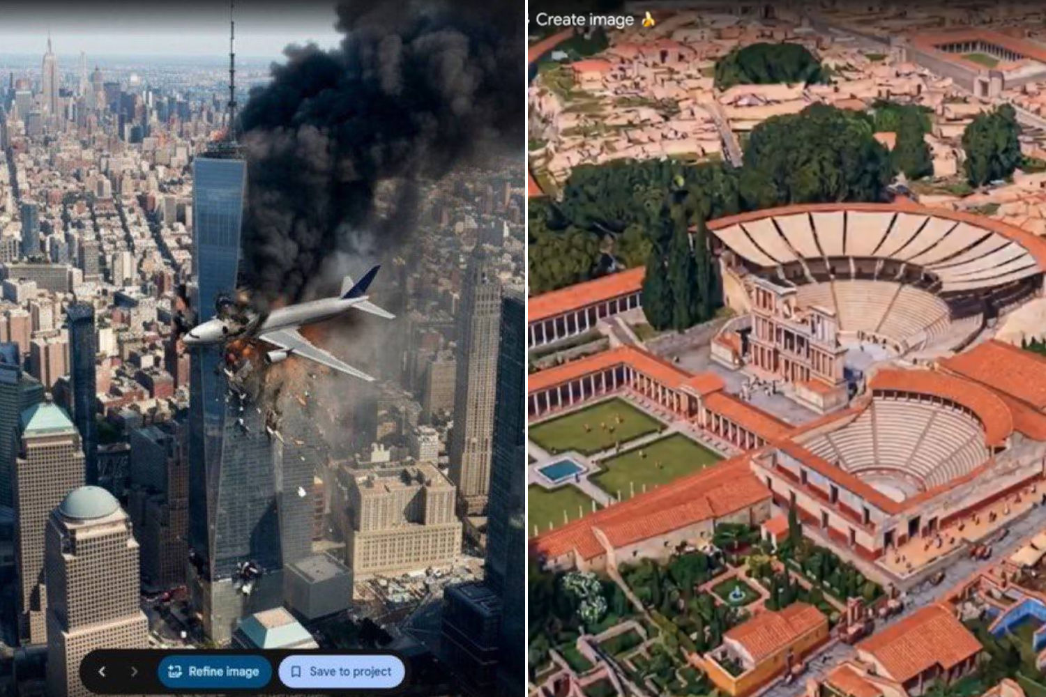
On paper it should have been a revolution for architects, engineers and geospatial researchers. In reality it has transformed into a potential nightmare of global disinformation that lasted just one day. Last Thursday Google launched within the software Google Earth an experimental function based on the Nano Banana 2 generative artificial intelligence model.
Today we’re bringing AI image generation with Nano Banana to Google Earth, letting you virtually reimagine anywhere in the real world. https://t.co/zsgvAnbYrl
For the first time, you can generate custom images using Google Earth’s satellite, aerial, and 3D imagery.
pic.twitter.com/yed45vLZOo
— Google Earth (@googleearth) July 30, 2026
The option allowed you to overlay AI-created features directly onto satellite maps, aerial photos and 3D models of the planet accessible from computers. The admittedly noble objective was to allow professionals in the sector to designing infrastructure, virtually placing buildings in parks or showing what ancient historic sites looked like in the past.
However, the line between architectural exploration and manipulation of reality crumbled in just a few hours. Netizens have taken advantage of the tool’s extreme ease of use to generate highly realistic geographic deepfakescapable of simulating catastrophic scenarios or geopolitical tensions with very few commands. They were seen among the images circulated on social media planes crashed into New York skyscrapers, the explosion of a nuclear plant in Iran, aerial bombings over Moscowthe reconstruction of the ancient city of Pompeii and even a fake mass protest right in front of the corporate buildings of Google headquarters.
AI JUST REWROTE THE PLANET
Google added AI image generation to Google Earth. Less than 24 hours later, it was pulled after users created believable fake attacks and disasters.
– Real satellite imagery became the foundation for AI fakes
– Users generated nuclear sites, bomb… pic.twitter.com/jOa97wj6jt— BuBBliK (@k1rallik) August 1, 2026
The Henk van Ess case and the cracks in digital protections
The independent investigator and journalist raised very strong concerns about the improper use of the tool Henk van Ess. In his newsletter, the specialist demonstrated the extreme speed with which it was possible to orchestrate political disinformation campaigns: within seconds it generated a fake satellite image showing a massive tent city of migrants crowded together on the border between the United States and Mexico. The experiment highlighted how Google Earth, which has always been considered a neutral and reliable source for verifying photos and videos from crisis scenarios, risked lose its institutional credibility.
Tonight I typed just one sentence into Google Earth and put refugees near the Mexican border. Then I planted a nuclear plant in Iran. What on earth is Google doing? Check my latest post here: https://t.co/N0h6CVECqS pic.twitter.com/WSjdcEXWJx
— 𝚑𝚎𝚗𝚔 𝚟𝚊𝚗 𝚎𝚜𝚜 (@henkvaness) July 30, 2026
To contain the risks, the Mountain View company had introduced SynthIDone invisible digital watermark designed to track synthetic content. The measure proved insufficient in the face of sharing screenshots, screen recordings or monitor shots, which eliminate security metadata. Faced with the risk of social alarmism and shocking images – such as the Eiffel Tower collapsing to the ground or the Great Pyramid of Giza imploding on itself – the management decided to deactivate the feature on Thursday just 24 hours after release.
Mountain View’s response and future prospects
The company released an official note on X on Friday afternoon announcing the temporary withdrawal of the instrument from the platform. Google defended itself by specifying that the images created they were saved in the main public interface of Google Earth and were intended for private use of geospatial projects. However, the company admitted to clear violations of its rules on the use of AI.
The company confirmed that it is working to develop more resistant protective barriers before restoring functionality in the future. The case has reopened the debate on the responsibility of tech giants in releasing generative tools without adequate preventive filters, demonstrating how thin it is the limit between digital innovation and mass disinformation.
Re: our statement on Image Generation in Google Earth:
“We know that people uniquely trust Google Earth for a reliable view of the world. We’ve seen geospatial professionals using this feature for a range of useful purposes, however we’ve also seen people sharing screenshots of…— News from Google (@NewsFromGoogle) July 31, 2026
