
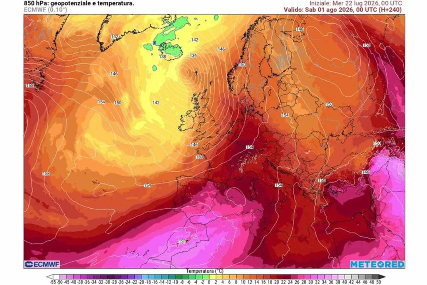
The African heat wave that is affecting Italy will reach its peak in the next few days, with values that could reach up to 39°C in the plains and inland areas of the Centre-North. But the hottest phase now seems to have an expiry date: from Friday 7 August the subtropical anticyclone will gradually begin to lose strength, favoring the arrival of more unstable currents and a partial reduction in the heat.
The change will not be immediate and will not involve the entire Peninsula in the same way. The first areas affected will be above all the northern ones, where the entry of cooler air at high altitude could trigger thunderstorms even on the plains, after days characterized by sun, sultriness and exceptionally high temperatures.
Still intense heat until Thursday 6 August
In the coming days, high pressure of African origin will continue to dominate the Italian meteorological scenario, guaranteeing stable conditions and mostly clear skies. The heat will remain the absolute protagonist, with temperatures further increasing and peaks close to 39°C especially in the flat areas of the North and in the internal areas of the Centre.
The high humidity will also make the situation worse, which will keep physical discomfort high, especially in the central hours of the day and in large urban areas.
Some episodes of instability may however affect the Alpine and Apennine reliefs in the afternoon hours, but without modifying the general picture dominated by the heat.
From Friday 7 August the scenario changes: first storms in the North
The turning point will come on Friday 7 August, when the anticyclone will begin to show the first signs of weakening. The arrival of more unstable currents from Northern Europe will favor the development of more organized storms, initially over the Alps and then possibly extending towards the northern plains.
The phenomena may be locally intense, accompanied by gusts of wind and, in some areas, even hailstorms. The passage of the storm will be followed by a decrease in temperatures, which however will not yet represent a real general refresh: the climate will remain warm, but less oppressive than the previous days.
What will the weather be like this weekend?
Over the weekend the Peninsula will experience a different meteorological situation. In the North, a more dynamic phase will continue, with greater variability and the possibility of new storms especially in the Alpine and pre-Alpine areas and locally on the plains of Lombardy, Veneto and Friuli Venezia Giulia. Intense phenomena with gusts of wind and local hailstorms will not be excluded.
In the Centre-South and on the islands, however, high pressure will remain more resistant: the sun will continue to prevail and the heat will remain intense, with temperatures still higher than the seasonal average, in particular on the Tyrrhenian slopes and in inland areas.
On Sunday 9 August the risk of stronger storms will mainly concern the western Alpine arc, with possible intense phenomena between Piedmont and Valle d’Aosta and some spillover into the nearby plains.
For a real refresher we will have to wait
The first change will therefore come with a more evident reduction in heat in the North, while for a more uniform temperature drop across Italy we will have to wait for the atmospheric evolution of the second half of August. Summer is not over: after the peak of the African phase, however, the dominance of extreme heat will slowly begin to loosen.
