
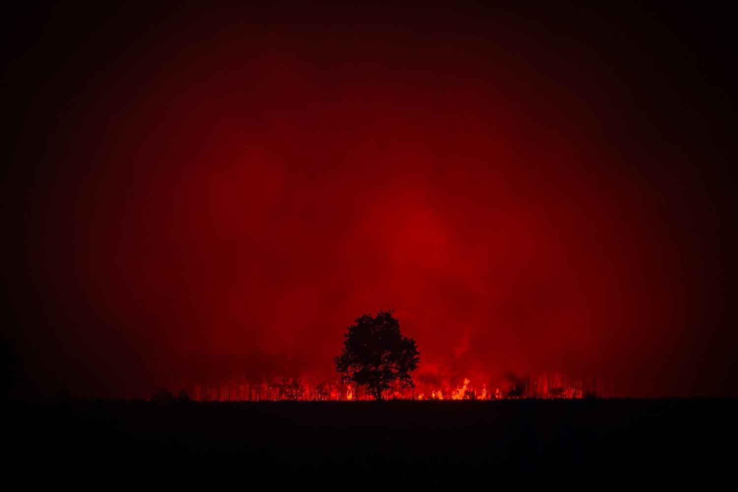
The sky above the fire in southwestern France has begun to behave as if it were part of the blaze. From the heat column, a pyrocumulonimbus was formed, a storm cloud fueled by flames that generates gusts, lightning and new outbreaks. This is the first time for the French firefighters. The phenomenon is especially known in Canada, Australia and the United States. Here he transformed an already enormous fire into a system capable of producing its own weather, changing direction without warning and forcing teams to give up direct attack. The fire, for a few hours, also dictated the wind.
In the budget released at 10pm on 26 July 2026, the Prefecture of Gironde indicated 42 thousand hectares covered in flames, around 220 thousand people evacuated and 2,500 firefighters involved, supported by air, military and police forces. The previous evening the fire had resumed violence right under the cloud, accompanied by intense electrical activity.
According to Éric Brocardi, spokesperson for the National Federation of French Fire Brigades, it is the first time that the country’s rescuers have faced a similar phenomenon. His words describe a rather rare condition in emergency communications: “operational impossibility”. It means that the fire, at least in its most violent phases, cannot be attacked head-on without exposing the teams to an unmanageable risk.
A cloud strong enough to change the wind
The official name is cumulonimbus flammagenitus. The World Meteorological Organization uses the term for cumulonimbus clouds originating from a localized heat source, such as a large fire or volcanic eruption. “Flammagenitus” means, with little imagination and a lot of precision, generated by flames.
The mechanism begins near the ground. Extreme heat rapidly pushes air, smoke, ash and moisture released from vegetation upwards. As the air mass rises, it expands and cools; the vapor condenses around the particles and forms a cloud. If the column continues to grow, it can turn into a real storm, with ascending and descending currents, ice, thunder and lightning.
The definition of “moisture-free cloud”, used in the first operational declarations, must therefore be handled with caution. For meteorological classification, a flammagenitus is composed at least in part of water droplets. However, it can produce very little useful rain or cause it to evaporate before it reaches the ground. Wind and electrical activity, on the other hand, come very well.
NASA describes these systems as large atmospheric chimneys, capable of carrying smoke up to the upper troposphere and, in the most powerful cases, into the lower stratosphere. Seen from the satellite they often have a white, swollen top, similar to that of a normal thunderstorm, resting on top of a much darker column. Except that the engine underneath is burning a forest.
Because the firefighters have to retreat
A fire driven by a relatively stable wind maintains a direction that can be studied, although it remains dangerous. A large convective fire instead begins to draw air from multiple sides and generate its own gusts. The front widens, accelerates, slows down and starts again elsewhere. The embers raised by the currents can fall from a distance and open new fires, while wind changes risk closing an escape route in a few minutes.
Even lightning requires some precision. A pyrocumulonimbus can produce thousands of them, but many remain within the cloud. Those that reach the ground can set fire to other dry vegetation. A study illustrated by NASA in 2025 showed how the relationship between smoke, electrical charge and new triggers is more complicated than the formula “every lightning starts a fire”. The danger remains, without the need to add special effects.
In these conditions the teams switch from attack to defense. They protect homes and infrastructure, organize evacuations, recover people and animals, build firebreaks and look for a sector where the fire has less fuel. Direct intervention resumes when the column loses energy, the wind stabilizes or the front reaches an area where it can be contained.
Brocardi spoke of a “strategic retreat”, a formula that measures the strength of the event without transforming the work of the firefighters into a surrender. Even retreating from a fire that moves the wind alone serves to prevent the emergency from adding more victims to those it is already threatening.
The climate prepares more extreme fires
The single trigger can have different causes, from accidents to human behavior. Global warming acts on the conditions that the fire encounters once it starts: higher temperatures, drought, dehydrated vegetation and reduced humidity allow the flames to release more energy and make fire seasons longer.
The World Meteorological Organization has been reporting for years the increase in the frequency and severity of the so-called fire weatherthe combination of heat, low rainfall, dry air and wind favorable to propagation. Precise scientific attribution requires studying this specific episode. The general context, however, increasingly offers fires the material necessary to become enormous.
France already has researchers and models dedicated to the interaction between fire and atmosphere. The CNRS studies mega-fires, fire vortices and pyrocumulonimbus to predict their evolution. Faced with such rapid phenomena, knowing the behavior of the convective column in advance can decide where to send a team and, above all, when to call it back. Meanwhile, in the Gironde, houses, sensitive sites, animals and evacuation roads are being defended while waiting for the front to lose strength.
