
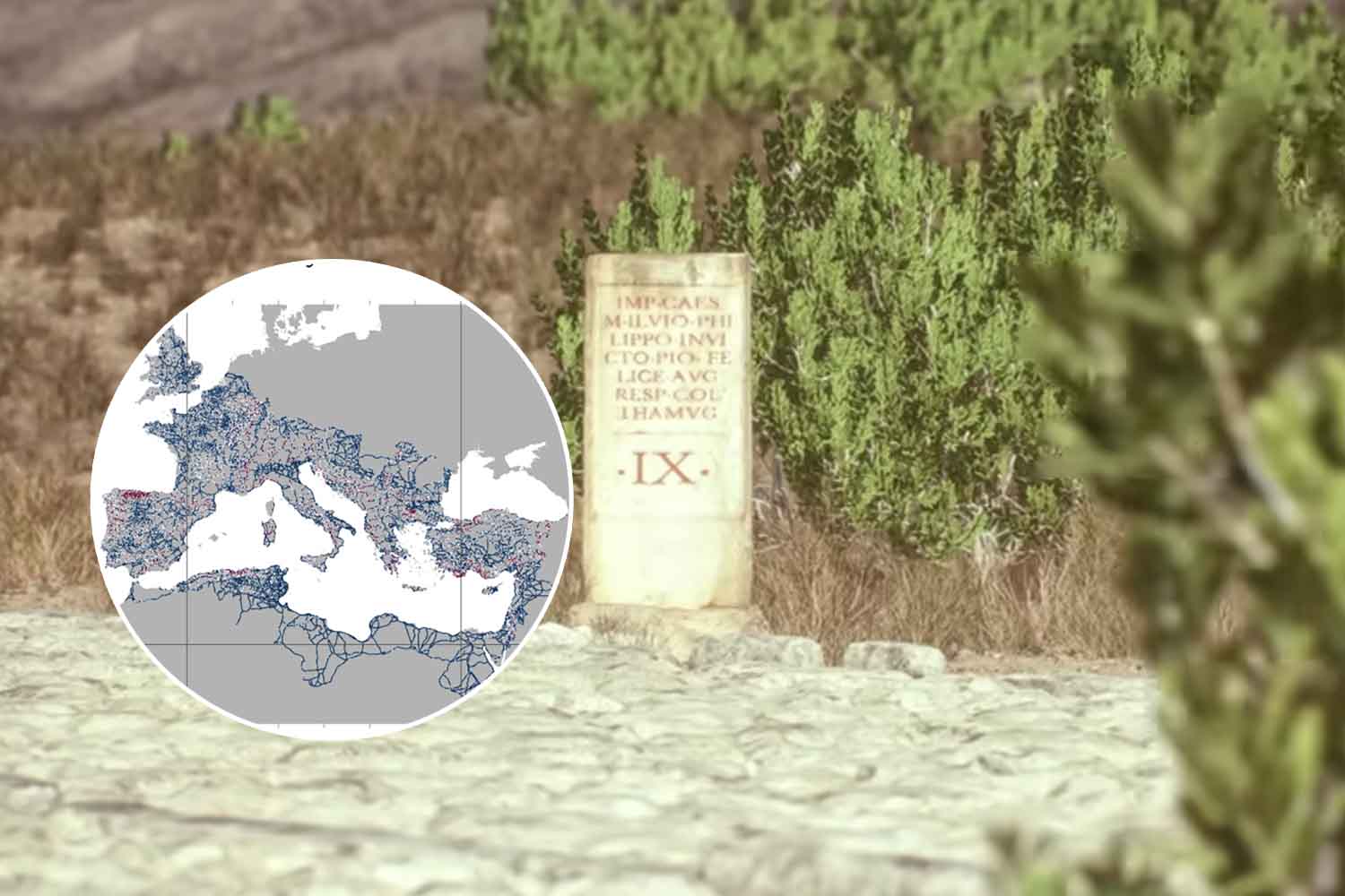
Take a Roman road, draw a line towards the capital and sooner or later you will arrive in Rome. More or less. The phrase we have repeated for centuries works much better as a proverb than as a description of the Empire’s road network: analyzing almost 300 thousand kilometers of roadsan international group of researchers discovered that, for land travel, cities such as Antioch, Ancyra – today’s Ankara -, Byzantium and Corinth occupied even more favorable positions than Rome.
The study published on Nature Communications brings together archaeology, cartography and network science to look at the Empire almost as we would today with a giant transport map. The result takes something away from the legend, but very little from the Roman engineers: the network was enormous, widespread and much more adapted to the territory than the postcards of the Appian Way suggest.
Rome was the capital, but there were better junctions on the road network
The analysis is based on Itiner-e, the digital atlas of the roads of the Roman Empire. The database takes a census 299,171 kilometers of routes distributed over over 5.2 million square kilometers: almost double the length that appeared in previous reconstructions. The authors transformed this web into a network made up of more than 10 thousand nodes and almost 15 thousand connections, to understand which roads and cities occupied the most important positions in land travel.
Here Rome loses its imaginary monopoly. The researchers calculated how often a road or city was located along the most time-efficient land routes. The great route that emerges passes through places such as Alexandria, Antioch, Nicomedia, Byzantium, Sofia, Aquileia and Narbonne, the current Narbonne. Rome remains central in the Italian peninsula, but it is not even on the road with the greatest temporal centrality in Italy.
Byzantium, on the other hand, had a formidable position: it allowed the European and Asian components of the network to be connected through the Bosphorus. Antioch, Ancyra and Corinth are also better placed than Rome as points of passage in the land network of the entire Empire. Provincial capitals, more generally, appear very often in strategic locations: 24 of the 45 analyzed fall into the top 20% for one of the measures used by the researchers.
Rather than an enormous sunburst with Rome in the middle, a system made up of many regional centers. Roads served to move armies, goods and people between cities, borders and administered territories. The Capital commanded the Empire. This did not force every cart to pass in front of us.
Roman roads were straight, as long as the geography agreed
Another very resistant image also falls: that of Roman roads thrown across the landscape like rulers. The engineers were really looking for the direct path. In the flat terrain of Western Europe, the Po Valley, Puglia, central Anatolia and North Africa, roads are generally very straight. Then came mountains, valleys and slopes and the geometry had to deal with something more stubborn: the ground.
The study measures this characteristic by dividing roads into one-kilometer segments and comparing their actual length to the distance as the crow flies between the two ends. The Roman roads are overall rather straight, but less so than the main modern roads, built with means capable of digging mountains, cutting slopes and modifying the landscape on a completely different scale.
Nonetheless, approx 90.6% of the reconstructed kilometers remain under a maximum gradient of 16%upper limit considered compatible with the passage of carts and animal-drawn vehicles. Even in the Alps the Romans managed to exploit favorable valleys and passes, intervening when necessary with terraces, retaining walls, cuts in the rock and, in exceptional cases, tunnels. The Appian Way, as we well know, really exists. It simply doesn’t represent a few hundred thousand kilometers of roads alone.
Two thousand years later, some traces are still under our wheels
The research also compared the density of Roman roads with that of major modern arteries. There is a relationship: the correlation calculated by the authors is moderate, equal to 0.46, and shows that a part of the transport geography built in antiquity has left traces until today.
It doesn’t mean that European motorways are simply ancient consular roads with asphalt on top. The ratio varies enormously from area to area. Cities that have grown over the centuries, industrial revolutions, new borders, rivers, mountains and economic transformations have shifted paths. Paris, Madrid, and other large modern centers, for example, developed much higher street densities than their location in the Roman network.
And the map itself has a pretty major limitation. The study that presented the Itiner-e database in 2025 specifies that only the 2.737% of the registered routes are known with certainty in their position. The others derive, with varying degrees of reliability, from the integration of archaeological excavations, historical sources, milestones, cartography and remote sensing. Some regions are also much better studied than others. The authors of the new work have verified how this uncertainty can influence the results, but the map remains a reconstruction, not Trajan’s satellite navigator.
Then there is a caution that changes the famous question of Rome a lot. The study only analyzes land connections. Due to long distances, in the Empire people also traveled a lot along rivers and especially by sea. The researchers themselves warn that by adding these routes, Rome’s position would become much more central, along with that of the large Mediterranean ports.
So no, at least on the mainland all roads did not lead to Rome. Some headed towards Antioch, others crossed Byzantium, still others limited themselves to taking one provincial city to the next. To really get to the center of the Empire, it was often best to leave the wagon and get on a ship.
