
The calendar says October, the thermometer disagrees. In the next few days the maximum temperatures will reach 28-30 °C in the Centre-North and will stop just below in the South, with values that at the beginning of autumn still feel like the end of summer. Thanks, or fault, to an anticyclone that does not let go of Eastern Europe and Italy and continues to block the way to Atlantic disturbances. This is the picture drawn by Luca Lombroso, meteorologist and editor of Meteored Italia, based on the models of the ECMWF European Centre. The rain, the real one, could appear only after October 5th. And there’s no betting on that either.
The Icelandic cyclone doesn’t break through
Over the upper Atlantic, south of Iceland, a deep extratropical cyclone formed with a minimum of 960 hectopascals. Its disturbance tries to descend towards the Mediterranean, but the anticyclone placed between Eastern Europe and the Peninsula forces it to dissolve before it breaches. Only isolated clouds arrive over Italy, and the turning point is postponed by a few days. The month thus opens with clear or cloudy skies almost everywhere. The exceptions are the Northwest and Sardinia, where some more compact accumulations will bring weak and completely sporadic rainfall. The Po Valley, already dry, will remain dry this time too. Temperatures are rising slightly: maximums between 28 and 30 °C in the Centre-North, around 26-28 °C in the South. Mornings and evenings remain cool, with minimums between 12 and 18 °C, nothing unusual for the period.
Weekend of October 3rd and 4th, more beach time
On Saturday 3 and Sunday 4 October the script does not change. Highs up to 26-28 °C, sunshine across much of the country and conditions suitable for a day at the beach or a visit to some village or city of art. Anyone who prefers the mountains will find stable weather for excursions and climbing in the Apennines and central-eastern Alps. The situation is different in the western reliefs, where some cloudiness persists with intermittent rain. Even at high altitude the climate remains unusually warm for the season: the freezing point is between 3,800 and 4,000 metres.
Monday 5th and Tuesday 6th, first rains in the Centre
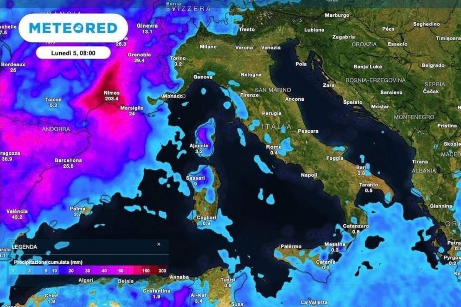
The first crack in the anticyclone could open at the beginning of the week. Between 5 and 6 October a depression between the central regions and Sardinia could bring showers and thunderstorms, especially on the Tyrrhenian coasts of Tuscany and Lazio. The North would be barely touched by some clouds, without any notable rainfall, while the South would remain dry and partly clear. On the thermal front, little changes: highs between 26 and 28 °C, cool but pleasant nights.
The turning point from October 7th? Hypothesis still weak
That weather maps change from one update to another should not be surprising, warns Lombroso. The models do not “change their minds”: they follow the normal evolution of the forecast, and the analysis of the probabilistic clusters serves precisely to line up the possible alternatives, and here, there are many alternatives. «There are, in fact, from 3 to 5-6 different scenarios», explains the meteorologist. «Some propose north-western flows over Italy that are not very productive of rain, especially for the north, protected by the Alps. Others propose a weakened and aged anticyclone». The real Atlantic turning point remains the minority hypothesis for now, with a probability estimated at around 30-40%. The prevailing scenarios indicate unstable flows directed towards the Centre-South, which would largely bypass the North at least until mid-month. For the northern regions, the ECMWF maps predict a possible return of rain between 12 and 19 October.
The unknown of the Tyrrhenian cyclone
The latest run of the ECMWF model, released on Wednesday 30 September, added a new element, namely the possible formation of a cyclone on the Tyrrhenian Sea between Thursday 8 and Friday 9 October, with bad weather and rain in many regions, a forecast to be taken with the utmost caution, because the clusters show five very different evolutions and the clearly cyclonic ones are in the minority; in other cases the disturbance would be weaker, more open or moved elsewhere. More than a prediction, a possibility to follow in future updates. The game, moreover, is not just about umbrellas. According to the meteorologist, the lack of rain in this phase risks worsening the drought in the very season that should recharge aquifers, rivers and basins. And the North gets there after a heavy summer. The Permanent Observatory on water uses of the Po Basin Authority recorded highly critical conditions across the entire district, without interruptions, between 16 June and 22 August. On September 16, the water severity dropped to “medium with precipitation,” and the next meeting is scheduled for October 21.
