
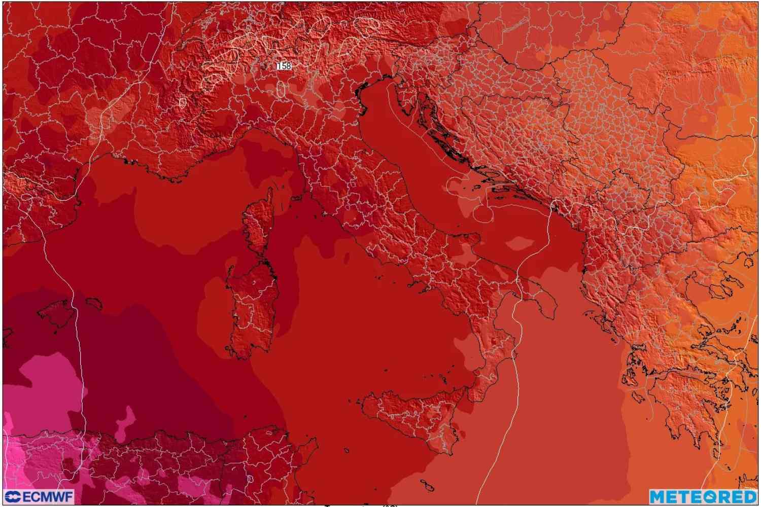
Here are the isotherms expected over Italy, at around 1600 meters above sea level, on the evening of Friday 19 June 2026 (ECMWF map taken from Meteored Italia).
An intense heat wave will hit Italy coinciding with the summer solstice on Sunday 21 June, the day on which the sun reaches the highest point of the year in the sky. What worries meteorologists is not so much the absolute values of temperatures, but rather the duration of the phenomenon: mathematical models indicate that Northern and Central Italy are heading towards a climate phase that is potentially record-breaking in terms of persistence.
The meteorological cause
According to meteorologist Luca Lombroso of Meteored Italia, a large anticyclone is strengthening over central-western Europe, bringing a pressure of 1025 hPa to northern Italy on Sunday. At high altitude, several factors combine: the subtropical dome of the African anticyclone, a weak trough to the west of Spain, heating by air compression (subsidence) and, naturally, the sun at its maximum seasonal height. With a convective temperature of 36°C, conditions for heat storms with very high cloud base will be created over the northern regions.
Friday 19th: full summer day
Clear skies across the entire peninsula, with the development of cumulus clouds limited to the Alpine and Apennine mountains, where short but intense heat storms are possible. Nighttime minimums will remain above 20°C, while maximums may reach 38°C in the Centre-North and 34°C in the South.
Solstice weekend: scorching heat
On Saturday and Sunday the heat will become oppressive in the plains and inland urban centres. Turin and Bologna could reach almost 39°C with humidity around 40%, cloudy skies and desert dust in the atmosphere; Verona and Perugia will remain more contained (35-36°C) but with higher humidity, which will make the heat particularly annoying. Lombroso explains that above 36 degrees the convection is self-sustaining, but given the dry and hot air the base of the clouds will be high: therefore possible “dry”, short and isolated thunderstorms, with little precipitation, many virga (rain that evaporates before touching the ground) and sudden and locally intense gusts of wind. On Saturday the phenomena will remain confined to the reliefs; on Sunday they could also extend to the Po Valley, with the risk of a dry microburst.
Start of the week: the heat doesn’t subside
The intense heat will continue in the Centre-North on Monday and Tuesday. The models agree on the duration of the phenomenon but differ on the values: the European ECMWF predicts peaks of 36-38°C with a slight decrease from Thursday, while the German ICON hypothesizes extreme temperatures between 38°C and 40°C for several consecutive days. Also in this phase, heat storms with orographic triggers are expected in the Alps and Apennines, generally short and isolated, with possible occasional breakthroughs towards the plains.
The prospects for the next few weeks
The heat wave has no clear temporal contours: temperatures above 30°C in the Centre-North have been recorded since mid-June, and ECMWF projections indicate persistent heat at least until early July, with no significant disturbances or refreshments in sight. The models are unusually consistent even in the medium term in excluding circulation changes: the doubt is not whether it will be hot, but how intense it will be. Even without absolute record peaks, we are heading towards a heat wave that could become historic due to its duration.
