
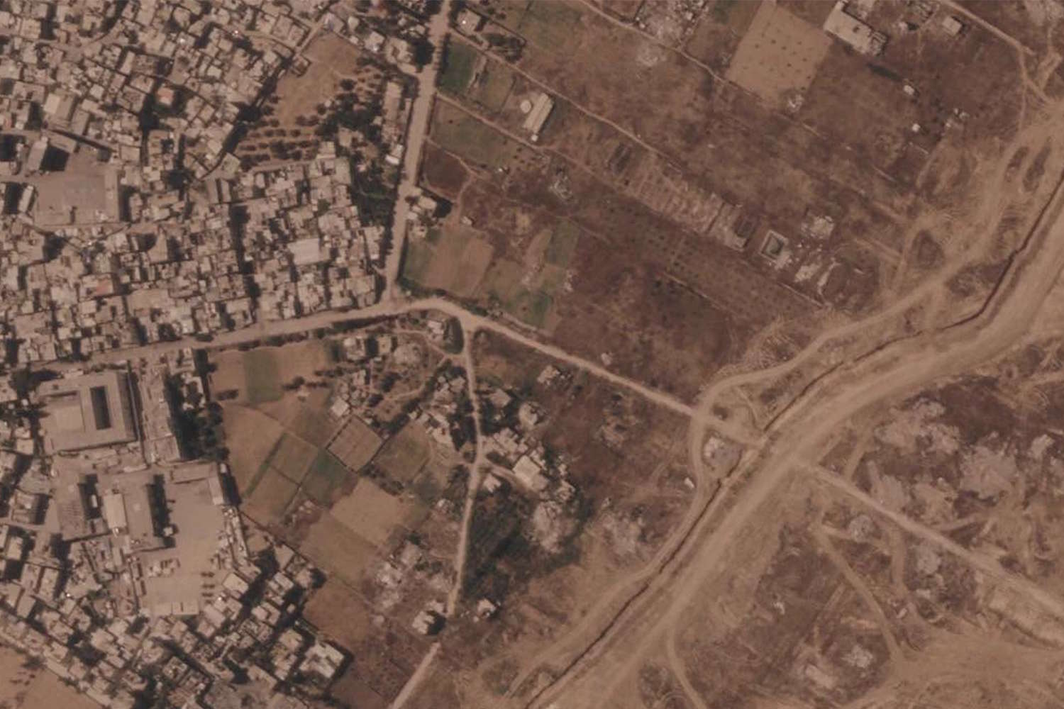
The world doesn’t know it, but as the spotlight shifts elsewhere, the geography in Gaza is changing. Slowly, fearfully, inch by inch, across a long earth barrier that crosses a territory already devastated by war.
This is told by the images from above collected by Planet Labs PBC satellites which show a new infrastructure that extends for approximately 23 kilometers within the Gaza Strip: a huge embankment accompanied, according to what the Israeli army reported, by a security zone equipped with surveillance systems and military technologies.
A barrier made of earth, but of enormous weight. Because it separates two areas and, above all, because it risks redesigning the future of an already deeply wounded territory.
According to the analysis of satellite images, construction began in recent months and accelerated in several areas and a stretch near Rafah, between the ruins of the city and the al-Mawasi area where many displaced Palestinians were concentrated, went from a few hundred meters to over two kilometers in just a few weeks.
Other segments of the barrier pass through areas near Khan Younis and Gaza City, while in the north of the Strip further sections appear near Beit Lahia, one of the areas most affected by the fighting.
The images tell of a silent transformation of the landscape: where before there were houses, roads and fields, today rubble, military bases and embankments appear.
@Planet Labs PBC
A wall in the heart of an already fragmented land
The Israeli army confirmed the construction of the barrier, explaining that its objective is to protect Israeli troops and communities near the Strip. But it goes without saying that for many Palestinians this new infrastructure fuels the fear that a separation that began as temporary could turn into a permanent division.
The so-called “Yellow Line”, foreseen in the ceasefire agreements as a temporary separation line, appears increasingly defined on the ground precisely through these physical works. Because when a line is dug into the earth, built with heavy vehicles and accompanied by control systems, it stops being just a mark on a map and becomes an everyday reality.
In addition to the barrier, satellite images also show widespread destruction of buildings and infrastructure in areas controlled by the Israeli army. Entire urban areas razed to the ground, while the Palestinian population is concentrated in increasingly smaller areas, often in precarious conditions and in strong need of humanitarian aid.
Wars leave wounds in people, but also in places. Roads change, towns are erased, the relationship between community and territory is modified. And sometimes the clearest sign of a war is not an explosion, but something that grows slowly over time: a barrier, a road, a new line on the earth.
And in Gaza, today, that border runs across the land but above all crosses the lives of millions of people.
